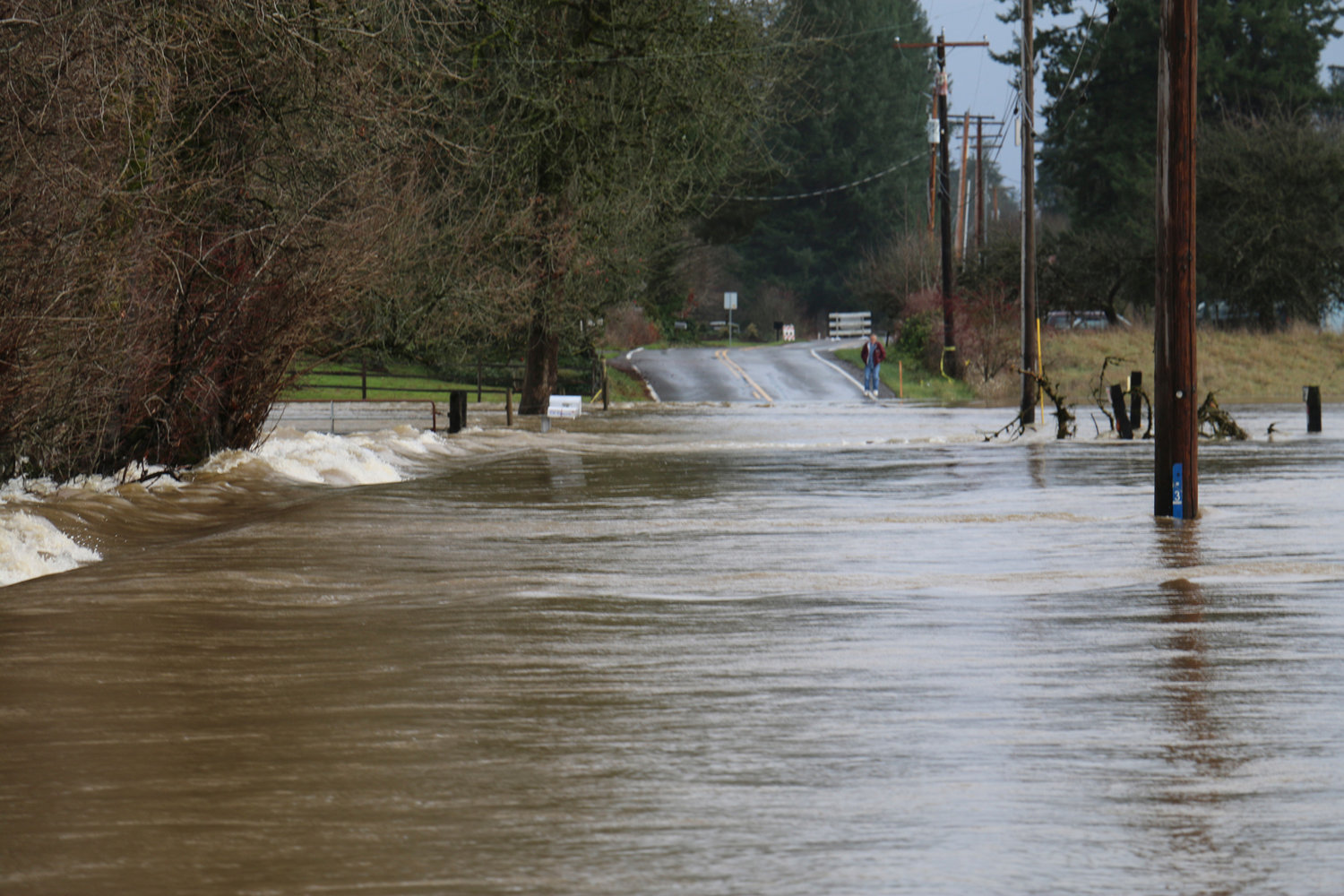
A person looks at the fast-moving water that swept over Independence Road on Dec. 10, 2015, in South Thurston County.

Horses drink flood water in the Independence Valley area in December 2015.

A field is covered with water on Thursday afternoon in the Independence Valley area after the Chehalis River saw moderate flooding.

Highway 12 near Rochester was closed on Thursday afternoon due to water over the roadway. There is no estimate for when the road will be reopened.

Rodney Youckton, CEO of Chehalis Tribal Enterprises, makes a phone call on the closed portion of Highway 12 near Rochester on Thursday afternoon. Youckton said tribal members displaced by the flood are being housed at Eagle’s Landing Hotel at the Lucky Eagle Casino.

Rodney Youckton, CEO of Chehalis Tribal Enterprises, makes a phone call on the closed portion of Highway 12 near Rochester on Thursday afternoon. Youckton said tribal members displaced by the flood are being housed at Eagle’s Landing Hotel at the Lucky Eagle Casino.

A truck makes its way through a flooded portion of Independence Road on Thursday afternoon.

An official with the Washington State Department of Transportation drives across the closed portion of Highway 12 near Rochester. The roadway was deemed unsafe for travel and shut down to vehicles. There is no estimate for when the highway will be reopened.

Residents of Independence Valley area make their way across Independence Road which was covered by flood waters from the Chehalis River on Thursday afternoon.

Water lines Highway 12 near Rochester after the roadway was closed to vehicle traffic. There is no estimate for when the highway will reopen.


Fields flooded, roads were closed and residents living along the Chehalis River from Centralia to Grand Mound and beyond were inconvenienced by moderate flooding on the waterway Thursday and Friday.
The river is expected to drop below flood levels completely by 4 p.m. Saturday.
The Chehalis River was the last of the four major rivers in Lewis County to hit flood stage this week. Like the Skookumchuck and Newaukum rivers, early predictions of extended periods of major flooding did not hold true.
Still, the inundation that occurred was enough to force the closure of U.S. Highway 12 at Moon Road near the Chehalis Reservation, which was also flooded, and many other roadways in Grand Mound, Rochester and the Independence Valley.
At the Chehalis Reservation, many tribal members were stranded until waters subsided, which allowed for the opening of U.S. Highway 12 Friday morning.
Rodney Youckton, CEO of Chehalis Tribal Enterprises, was at the U.S. Highway 12 closure on Thursday, monitoring the flow of the water over the roadway. He said tribal members displaced by the flood were staying at Eagle’s Landing Hotel at the Lucky Eagle Casino until floodwaters receded.
The tribe’s focus is on assisting elders first, he said.
“At least they’re above the floodplain warm and safe,” he said.
With 170 rooms, Youckton said, there was plenty of space to house those who were displaced.
During periods of flood, Youckton said, it isn’t unusual for the reservation to be cut off due to road closures. Along with Anderson, Moon and James roads, Howanut Road was also inundated with water on Thursday.
Because of the flooding conditions, the Lucky Eagle Casino was closed Thursday morning, Youckton said.
Elsewhere in South Thurston County, residents reported relief that the floodwaters never rose to the threshold of major flooding, which was initially predicted by the National Weather Service.
Totals fell below the 17-foot mark required to be designated as major flooding. Early predictions had predicted a much higher, longer crest.
Instead, the river crested at 16.84 feet.
Asha McElfresh and Melissa Southwick said water over the roadways in Independence Valley was significant, but nothing compared to what they experienced during the 2007 and 2009 floods.
Both women reside in the area and were walking through the floodwaters as they passed over the road Thursday afternoon.
Southwick said Independence Road Southwest doesn’t flood too often ever since work was done on the road after previous floods.
On Thursday morning, water covered some portions of the roadway. Though it was still considered passable according to Thurston County, several areas had rushing water more than 2 feet in depth.
McElfresh, who owns Wobbly Cart Farm, was without power on Thursday, and much of her fields were covered with water, which was several feet deep in some parts.
The two were out for a walk with their children to see how the recent rains had affected the area.
“We’re used to it, but it’s always kind of exciting to see,” McElfresh said.
As for Centralia, the Chehalis River reached minor flood stage and crested at 66.64 feet at 1 a.m. Thursday morning.
A river reading on Friday put the river at 64.01 feet, below the 65 feet flood level. Water levels are expected to continually decrease throughout the weekend.
With areas recovering from flooding issues, Andy Hainer, forecaster with the National Weather service in Seattle told The Chronicle the storms to come are not predicted to bring enough precipitation for more flood conditions.
“The good news, especially in terms of river flooding, is none of the rain we are expecting here on out is going to cause any additional river flooding,” he said, adding that snow levels will be down around 3,500 feet. “That really starts to lessen the amount of water coming in from the Cascades.”


