
The incident management team for the Goat Rocks Fire predicts possible moderate fire spread in the next several days, according to an update released Wednesday morning.
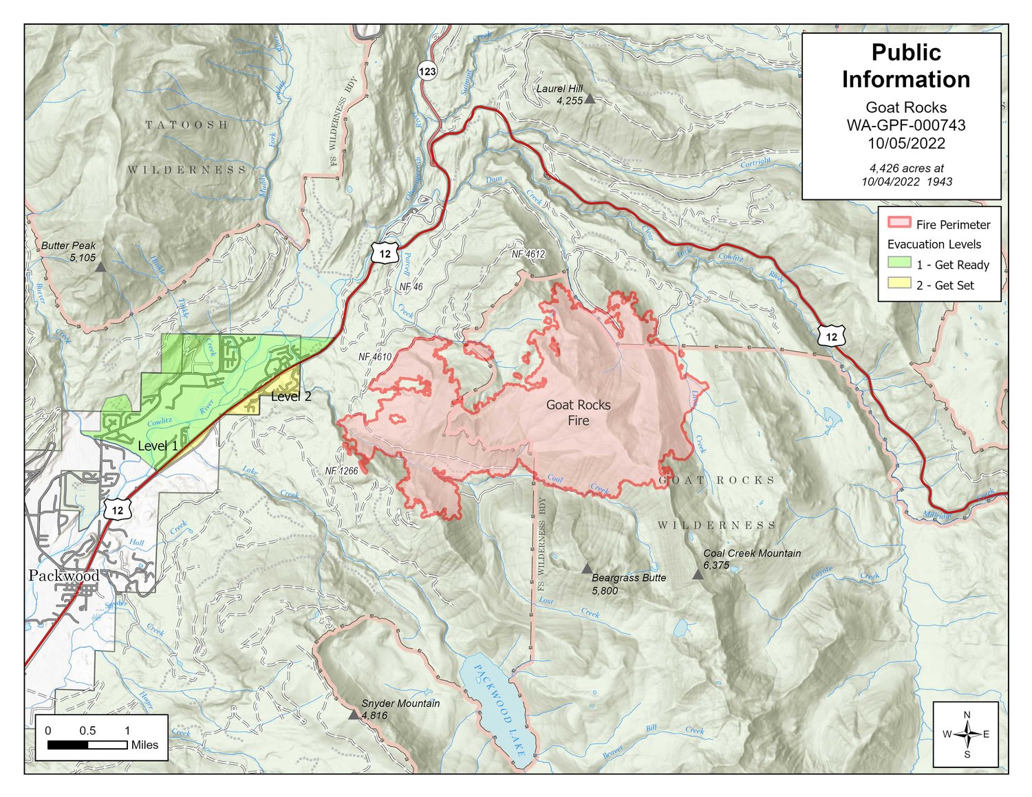
The Goat Rocks Fire had burned 4,249 acres and was 0% contained as of Wednesday morning, according to the incident management team update.
The fire, which was sparked by a lightning strike in early August, has continued to push toward the ridge south of Coal Creek and Three Peaks Trail, according to incident management. The combination of hose lay, handline and dozer line continues to hold the fire at the ridge.
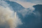
Fire activity increased as the inversion lifted Tuesday, according to incident management. Vegetation is increasingly dry given the fire has been creeping along the forest floor for almost two months, and individual trees and groups of trees are igniting within the fire perimeter, producing columns of smoke. Officials expected that pattern to continue when Wednesday’s marine layer lifted.
Slightly cooler temperatures on Wednesday, combined with that morning’s marine layer, increased the relative humidity to 30% and moderated fire activity at lower elevations, according to incident management. The high-pressure system is forecast to remain in the region through the end of the week, keeping temperatures at or above the high 70s through Sunday.
Areas northeast of Butter Creek and north of U.S. Highway 12, including Lower Timberline and Goat Rocks, were still at “be ready” evacuation status on Wednesday. Upper Timberline remained at a “be set” evacuation status.
Firefighters continue to prioritize structure preparation and patrol near communities, with an engine patrolling communities and U.S. Highway 12 overnight, according to incident management.
Nevada Incident Management Team 4 is designing contingency lines in between the control lines and the community. Helicopters continue bucket work south of the Coal Creek drainage.
The incident command team and the Gifford Pinchot National Forest will hold a community meeting at 6 p.m. on Friday, Oct. 6. Attendees can either join in-person at the Packwood Fire Department, located at 2953 U.S. Highway 12 or online via Facebook live @GiffordPinchot.
Campfire bans and restrictions are still in place. For a full list of fire restrictions, visit https://www.fs.usda.gov/alerts/giffordpinchot/alerts-notices.
For information about road and trail closures visit https://www.fs.usda.gov/Internet/FSE_DOCUMENTS/fseprd1060181.pdf.


