A return to warmer, drier weather at the Schneider Springs Fire means crews are anticipating more active fire behavior, fire information officer Michele Laboda said Thursday.
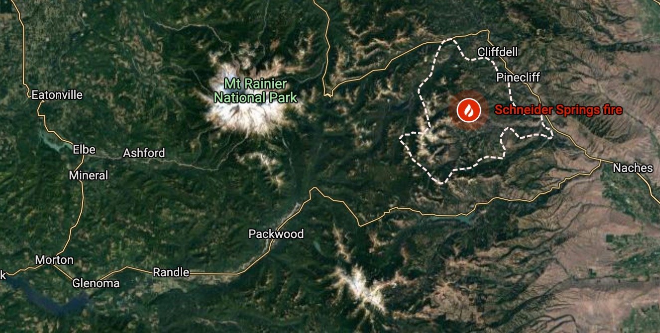
The fire burning 18 miles northwest of Naches was 105,523 acres Thursday, according to the daily fire update, which is about the same as the acreage reported Wednesday. Laboda said no infrared flight was done overnight, so no new fire growth was captured.
The fire is slightly more than six times the size of the city of Yakima. It is 32% contained.
Gusty winds late in the day Wednesday caused some movement on the northwest corner of the fire, but there wasn't anything unexpected, operation section chief Dean Lange said in a video update.
The fire did reach a roadway near Cliffdell overnight, Lange said, but a nighttime crew responded and no problems were caused. Movement like that is natural fire behavior, he said.
"This fire continues to make little tiny runs, roll out and start new ones," Lange said. "It's just what fire does, especially this time of year."
The southeast edges of the fire are in control, Lange said. The containment line is completed in those areas, but crews are continuing repair work on Russell Ridge, Bethel Ridge, Soup Creek and the Nile roads, the daily update said.
Smoke
The custom smoke outlooks created for communities near the Schneider Springs Fire ended Thursday, according to the U.S. Forest Service and Washington State Department of Ecology.
Air resource specialists said recent rains have diminished the amount of smoke coming from a number of fires in Washington, including the Schneider Springs blaze. Because of this, the air specialists who created the local outlooks are no longer working with fire teams in Washington.
The public can still see local air quality conditions by visiting the Washington Smoke Blog.
Air quality was good in Yakima Thursday.
Evacuations
Level 2 "be set" evacuation notices remain in effect along State Route 410 in the following areas:
* The intersection of Little Naches Road and SR 410 to Wash Creek and SR 410.
* The intersection of SR 410 and Bumping River Road to Sunrise Creek.
* The west side of SR 410, from the intersection of SR 410 and Swamp Creek Road, then going south to the intersection of SR 410 and the south end of Old River Road, to include all Old River Road, Lost Creek Road, Wapiti Run Lane, Linker Lane and Fontaine Lane.
A map of the evacuation areas is available at the Yakima County Emergency Management Facebook page.


