Area residents flocked to the Chehalis River Basin Flood Warning System in record numbers during the January flood events.
The system’s website received 33,700 individual logins during the month, with 25,000 logins during January’s first week.
By comparison, the logins for January 2021 only reached 6,800.
One portion of the website even received 75,000 interactions on Jan. 6 and Jan. 7 alone.
Scott Boettcher, staff to the Chehalis River Basin Flood Authority, said even though January 2021 was a dry year, the year-over-year uptick in users of the flood warning system shows that people use the system when they need it.
That was the whole point of creating the system a decade ago, Boettcher said — to give people access to reliable flood information they didn’t have the ability to obtain before.
“The flood warning system is intended to be kind of a first line of defense, if you will,” Boettcher said. “It’s an opportunity for people to easily and readily access flood information so that they have as much warning as possible. The intent was to bring the (flood) information that’s already out there into a single place to make it easier to access for folks.”
He said the flood of 2007 was a surprise in regard to its severity, which wasn’t accurately predicted by the National Weather Service at the time.
So when Chehalis River Basin Flood Authority officials observed the lay of the land following the floods of 2007 and 2009, they realized there were places in the basin that didn’t have river gages.
To remedy this, the Flood Authority installed about 13 additional river gages to collect data on river levels and flows to then be gathered and presented to the public in one place.
With technology improving every day — from doppler radars, to more knowledge of how atmospheric river weather events function in addition to the additional river gages — the Chehalis River Basin Flood Authority was able to get ahead of the curve when warning the public about January's flooding events, Boettcher said.
He said the Flood Authority was committed to not letting a “catastrophic” disaster like the 2007 flood catch the region unaware ever again.
“So today, there should never be a surprise,” Boettcher said. “So that was the original idea, was: ‘We’ve got to take the surprise factor away so that people know what’s coming in the future and they have time to plan for it, prepare for it.’”
The U.S. Geological Survey, Chehalis River Basin Flood Authority and the Department of Ecology all have river gages in the basin that are used for the flood warning system.
“So there’s a lot of instrumentation in the basin that’s collecting realtime information about what’s happening in our rivers, how much rainfall is happening in our community,” Boettcher said. “That information is collected through radio telemetry. Ultimately, now it goes to the National Weather Service. So they’re constantly recalibrating their forecast based upon what’s actually happening on the ground.”
There are 13 gages in the basin that have alarms to alert people when river water is approaching flood stage.
He said folks can sign up for just one of the gages, such as the one closest to their property, or all 13 of them to get the most up-to-date information on the region's water levels.
The flood warning system will generate an email when water levels are at certain intervals — say 1 or 2 feet below flood stage — and the recipient of the email will then have time to do things like pull their stuff out of the basement to store in the attic, move their animals or get a grandparent to safety.
“And that helps emergency managers, too, because if people have already gotten themselves out of harm’s way, then the emergency managers have more time to do other things and not have to go rescue people because they were not informed,” Boettcher said.
Those signed up for alerts increased by over 10% during the January flood events — up to 1,544 from about 1,350.
There’s an aspect of the Chehalis River Basin Food Warning System that sets it apart from others across the nation.
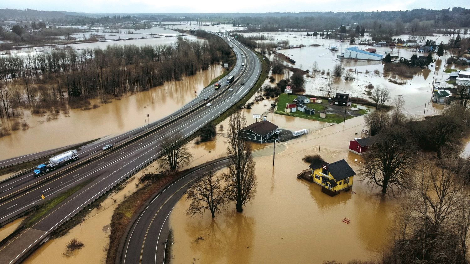
The flood warning system website has interactive inundation maps where people can see where the flood levels are currently, where they are projected to go and what the flood would look like if the rivers were to rise to a selected level.
“There’s a small number of systems across the country that have that availability, and Chehalis is one of them,” said David Curtis with WEST Consultants, a water resources consulting firm that helps oversee the operations of the Chehalis River Basin Flood Warning System. “You can look ahead, for example, and see when the access road to the hospital is going to be under water.”
Curtis has worked on “dozens and dozens” of flood warning systems across the United States and in 18 foreign countries. He is currently working with Peru’s flood warning system.
When The Chronicle caught up with Curtis last week, he’d for a couple days been at a workshop in Texas for the National Hydrologic Warning Council, which he said was the only professional association dedicated solely to flood warning systems.
As Curtis has it, the system’s handling of January’s flood events left others at the workshop impressed.
“I was at dinner last night with the person who runs the flood warning system for the City of Fort Worth, and they have a nice system, but he was speechless when I told him what we were doing in the Chehalis Basin,” Curtis said. “What he just kept marveling at was the fact that we had 25,000 individual logins to the website during that first week of January when the flood occurred.
“And in about two days we had about 75,000 hits on the flood-inundation-map portion of the website,” Curtis continued. “Yeah, his jaw was on the floor. … He was flat-out amazed.”
The Chehalis River Basin Flood Authority recently did a survey requesting information about the users’ experiences with the system in January.
Boettcher shared a few of the responses:
“Our house flooded in ‘96 and ‘07,” wrote one responder. “We like to be prepared. The gages and alerts give us more peace of mind. More information gives us more peace of mind.”
“The system keeps us informed of changing situations, and allows ample time to protect the property and personal safety of our employees,” wrote another responder.
In all, about 20% of those contacted for the survey responded.
The largest criticism, Boettcher said, was that the Flood Authority could do more with communicating the information and presenting it in a way that is easier for a person unfamiliar with the systems of rivers to understand.
The Chehalis River Basin Flood Warning System can be accessed online at https://www.chehalisriverflood.com. High-water alerts can be signed up for at https://chehalis.onerain.com/upload/files/6a9bf8e2-f04b-4165-8a9f-ce031d5db6b4.pdf. A flood-information dashboard can be accessed at https://chehalis.onerain.com/dashboard/list, The flood inundation maps can be found online at http://www.chehalisriverflood.org/.


