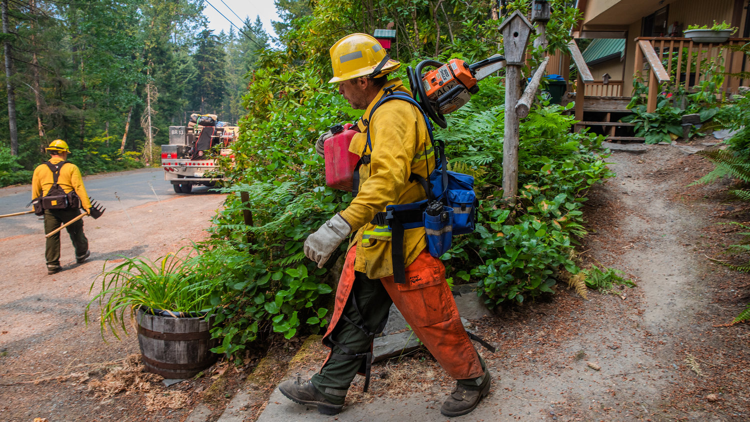
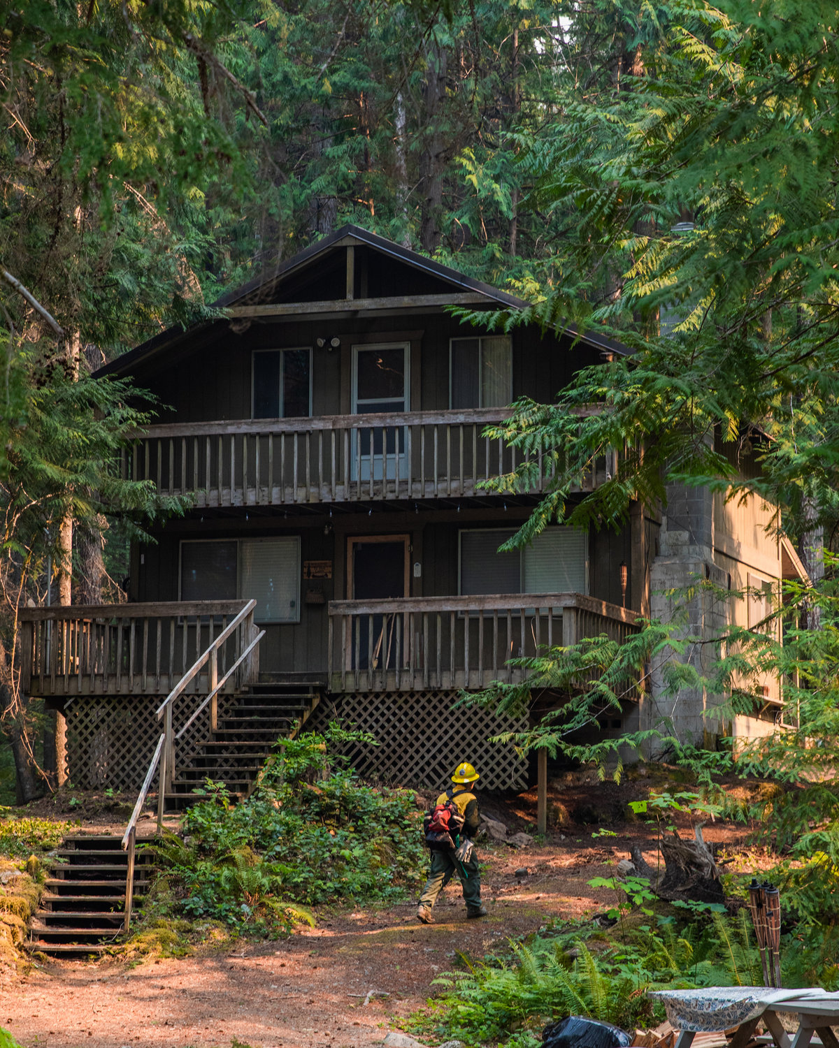
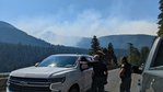
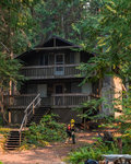
Firefighters carry gear while conducting structural triage in the upper Timberline area Saturday afternoon in Packwood.
Photos By Jared Wenzelburger / jared@chronline.com
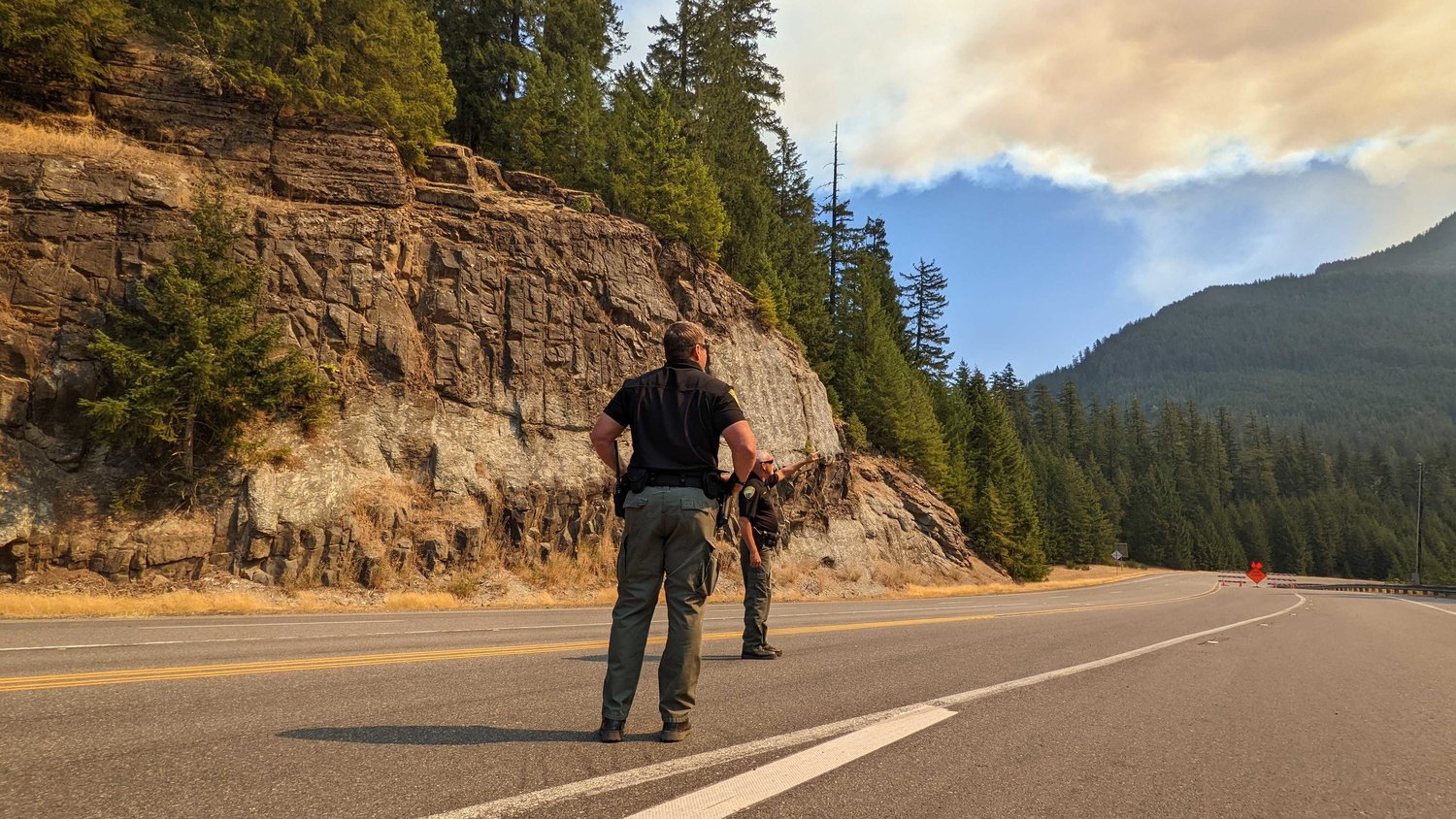
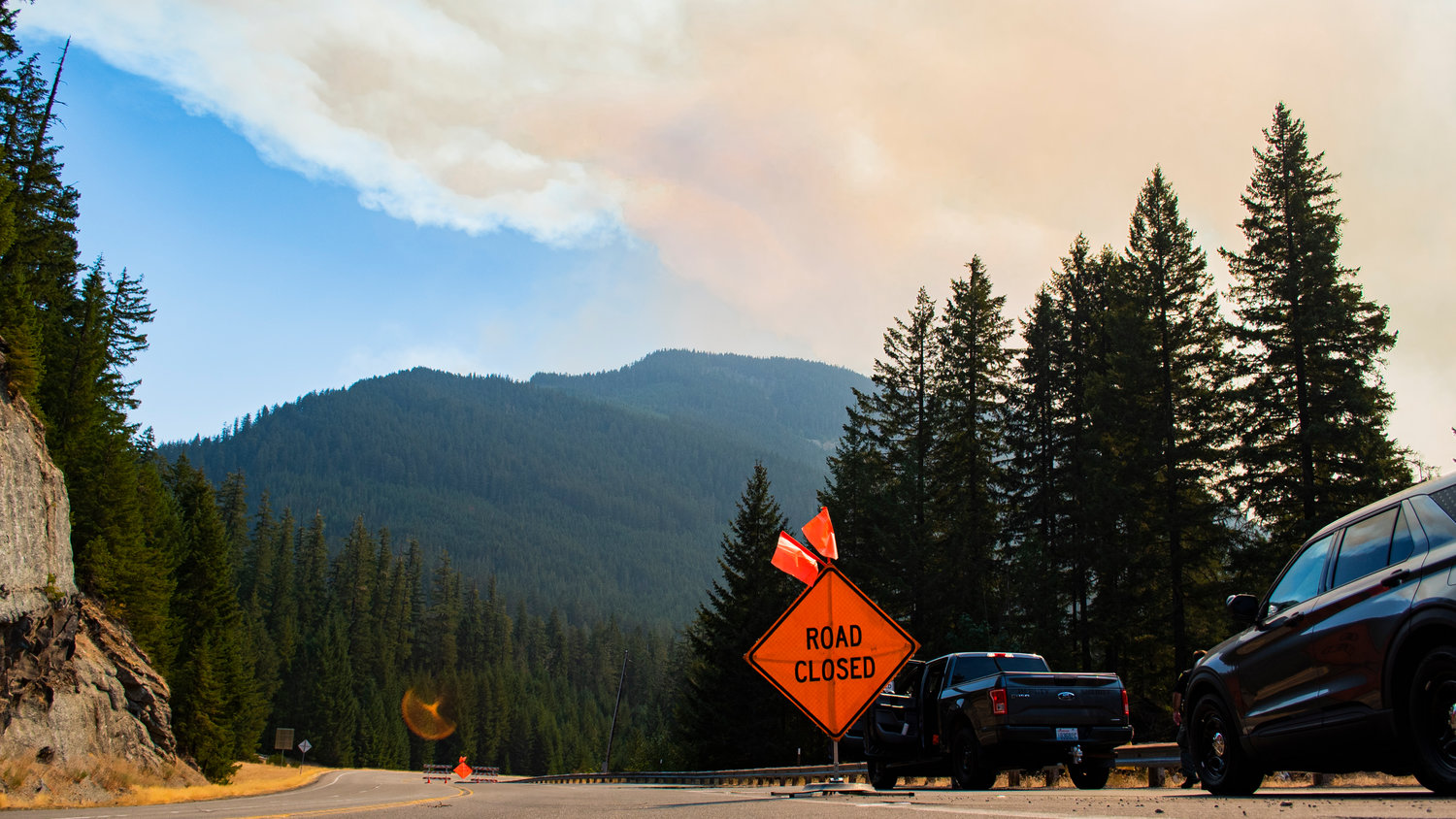
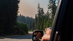
At right, Lewis County Sheriff Rob Snaza stands in the closed U.S. Highway 12 Saturday while pointing out the movement of smoke from the Goat Rocks Fire.
Isabel Vander Stoep / isabel@chronline.com
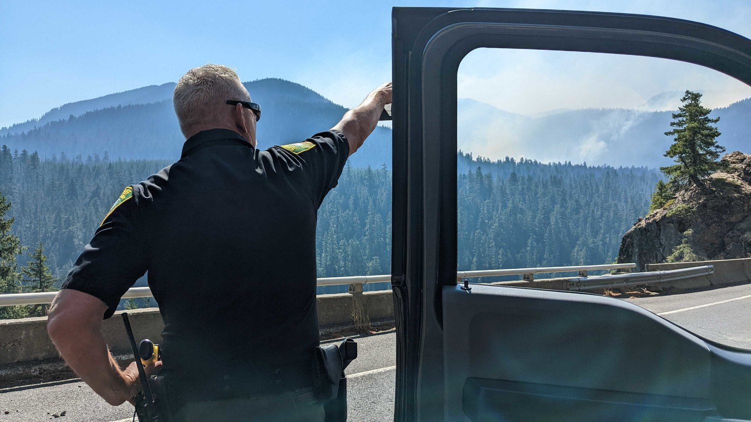
At right, Lewis County Sheriff’s Office Field Operations Chief Dusty Green walks to his patrol vehicle on U.S. Highway 12 Saturday afternoon as Sheriff Rob Snaza stands in the closed road to observe smoke from the Goat Rocks Fire.
Isabel Vander Stoep / isabel@chronline.com
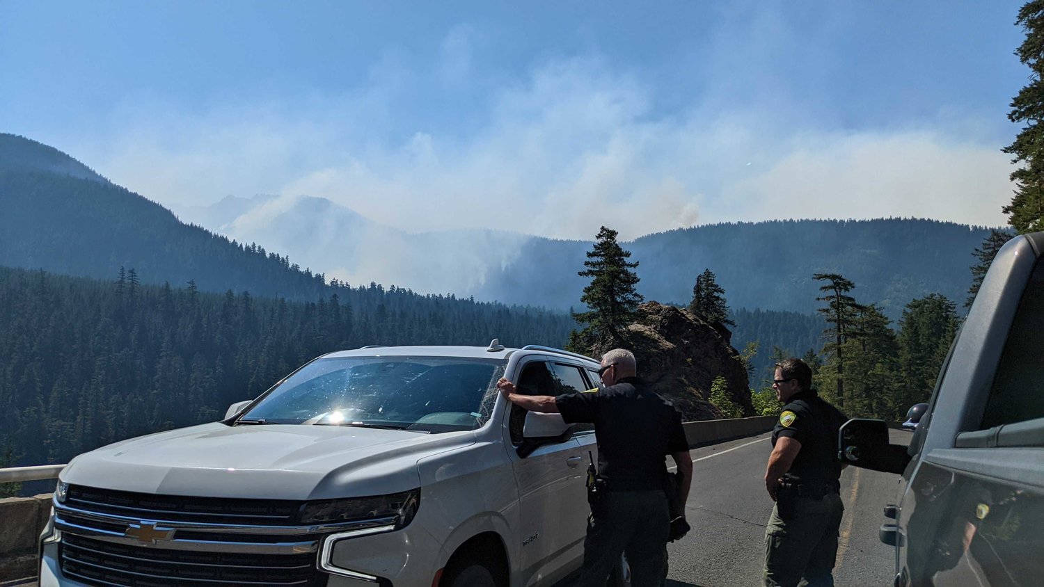
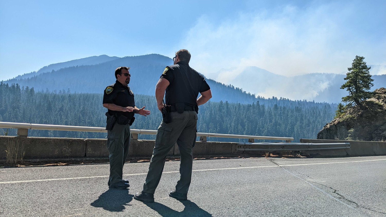
Lewis County Sheriff Rob Snaza and Captain Rick Van Wyck speak with incident commander Rocky Ahshapanek on U.S. Highway 12 Saturday afternoon as smoke from the Goat Rocks Fire rises in the distant hills.
Isabel Vander Stoep / isabel@chronline.com
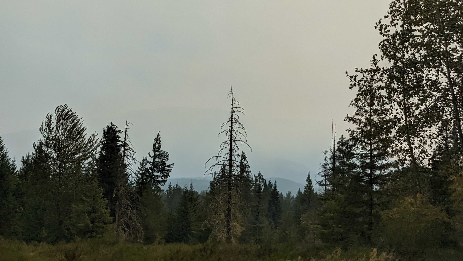
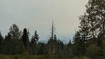
Smoke from the Goat Rocks Fire fills the sky, seen from High Valley Saturday afternoon.
Isabel Vander Stoep / isabel@chronline.com
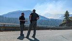
Lewis County Sheriff’s Office Captain Rick Van Wyck stands on U.S. Highway 12 Saturday afternoon as he and Sheriff Rob Snaza observe smoke from the Goat Rocks Fire rising.
Isabel Vander Stoep / isabel@chronline.com
Lewis County Sheriff’s Office Field Operations Chief Dusty Green speaks with Captain Rick Van Wyck on U.S. Highway 12 Saturday afternoon as smoke from the Goat Rocks Fire rises in the distant hills.
Isabel Vander Stoep / isabel@chronline.com
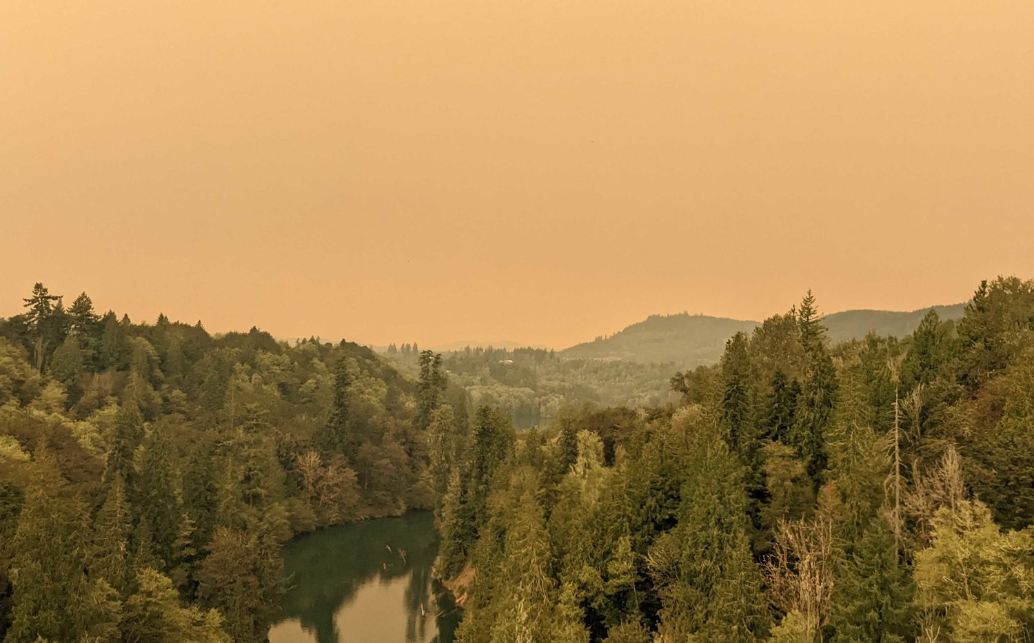
The sky over the Cowlitz River glows orange with sunlight and smoke near Mossyrock on U.S. Highway 12 Saturday afternoon.
Isabel Vander Stoep / isabel@chronline.com
The Department of Natural Resources and other firefighters use ribbon tags to communicate with one another about the evacuation status of residents in houses. These show an evacuated lawn with an abandoned kid's bike and relocated propane tank in the Timberline neighborhood.
Isabel Vander Stoep / isabel@chronline.com
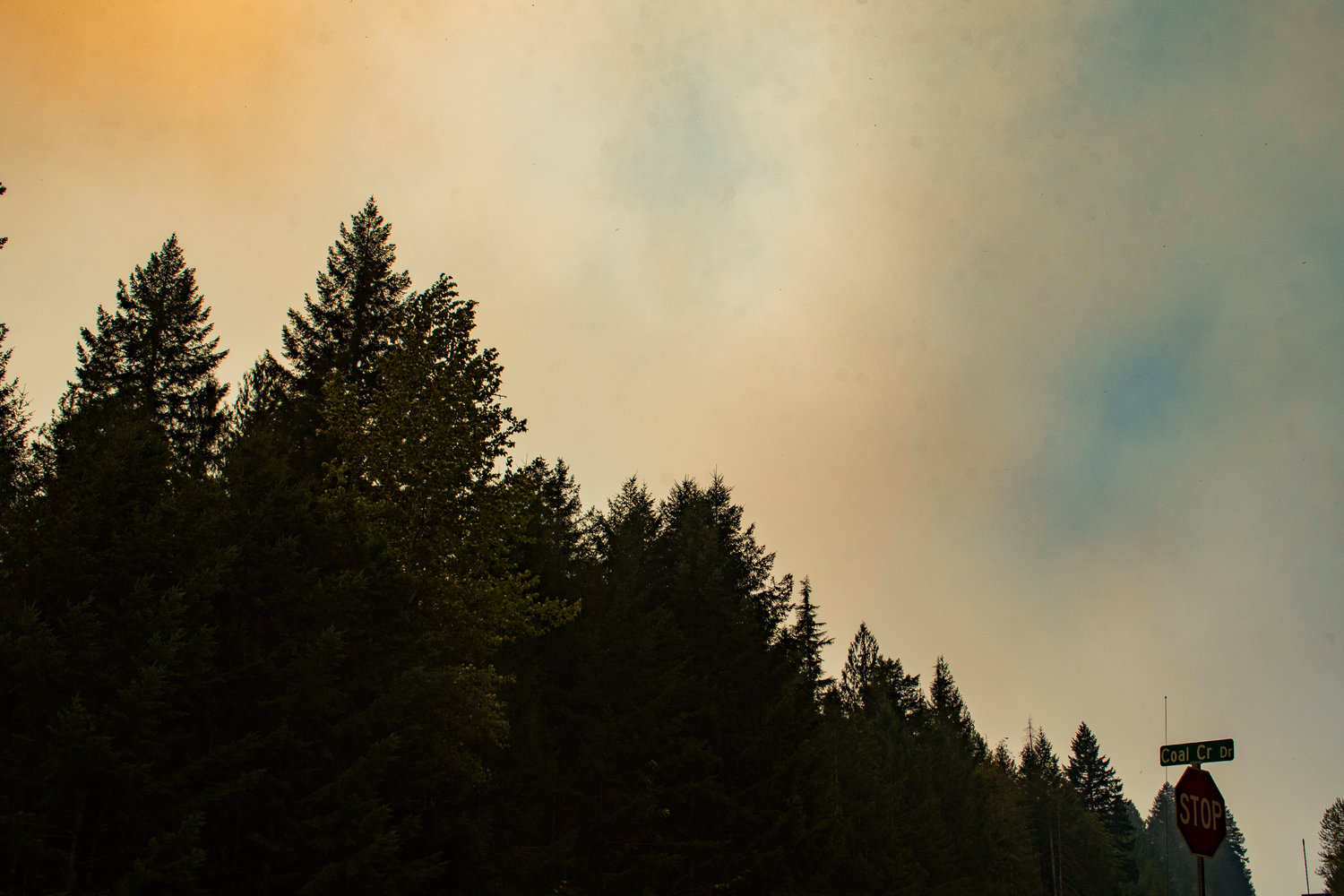
Smoke from the Goat Rocks Fire rises in heavy orange plumes above the trees near Coal Creek Drive east of Packwood.
Isabel Vander Stoep / isabel@chronline.com
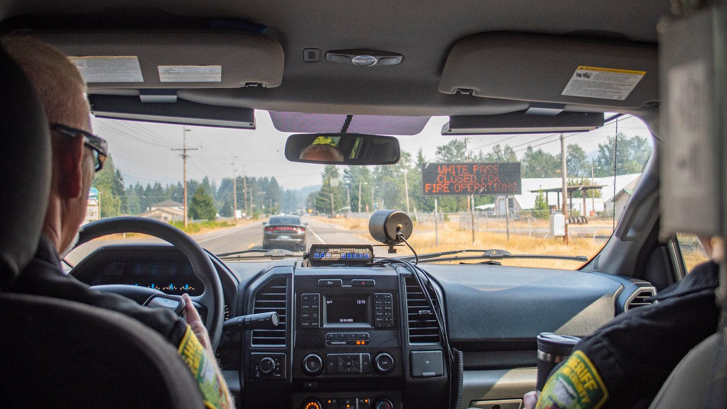
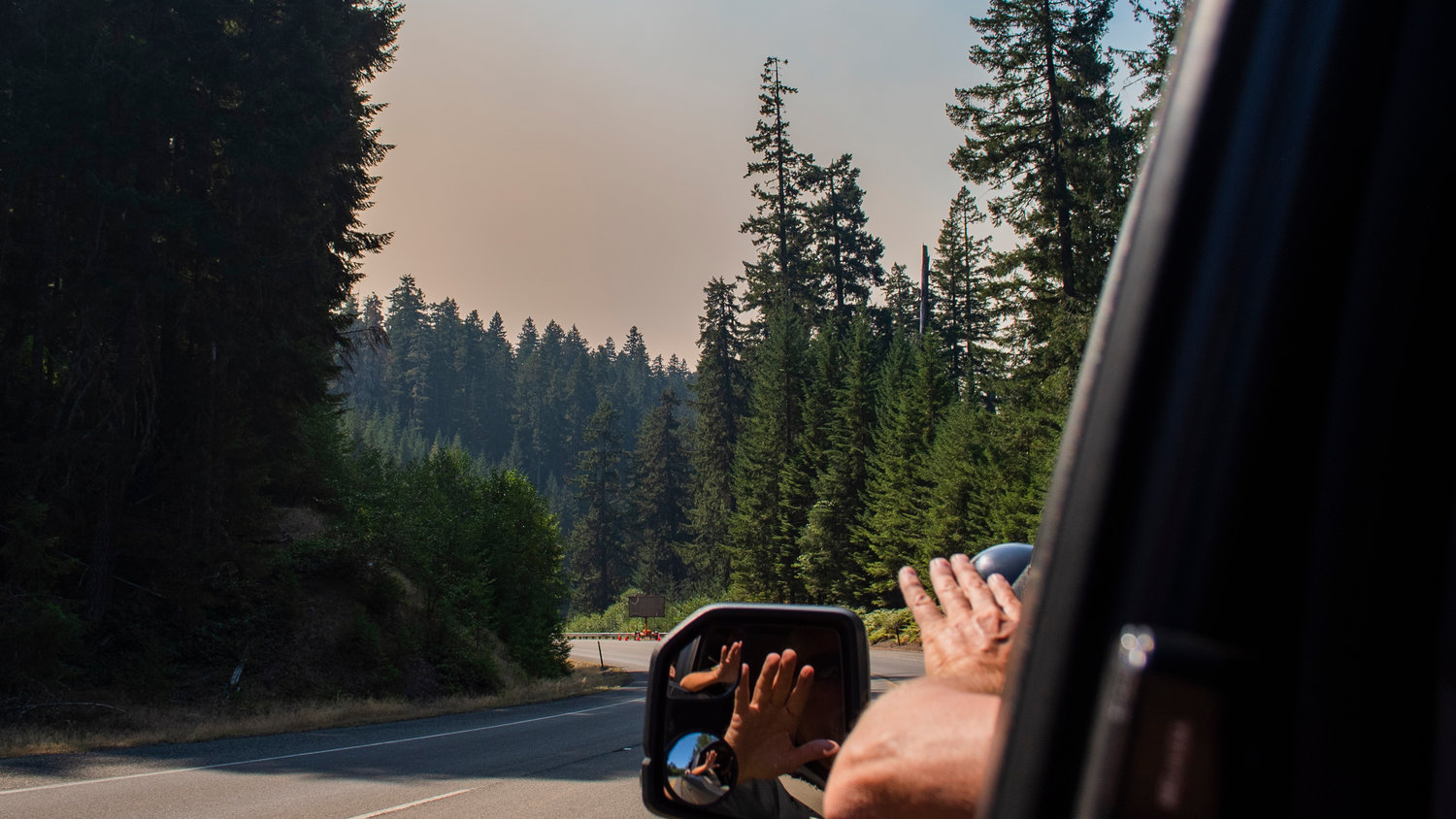
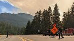
A sign warning the closure of U.S. Highway 12 is seen Saturday through the windshield of a Lewis County Sheriff’s Office patrol vehicle as Sheriff Rob Snaza and Captain Rick Van Wyck take a reporter with The Chronicle on a ridealong into the zone under evacuation orders due to the Goat Rocks Fire northeast of Packwood.
Isabel Vander Stoep / isabel@chronline.com
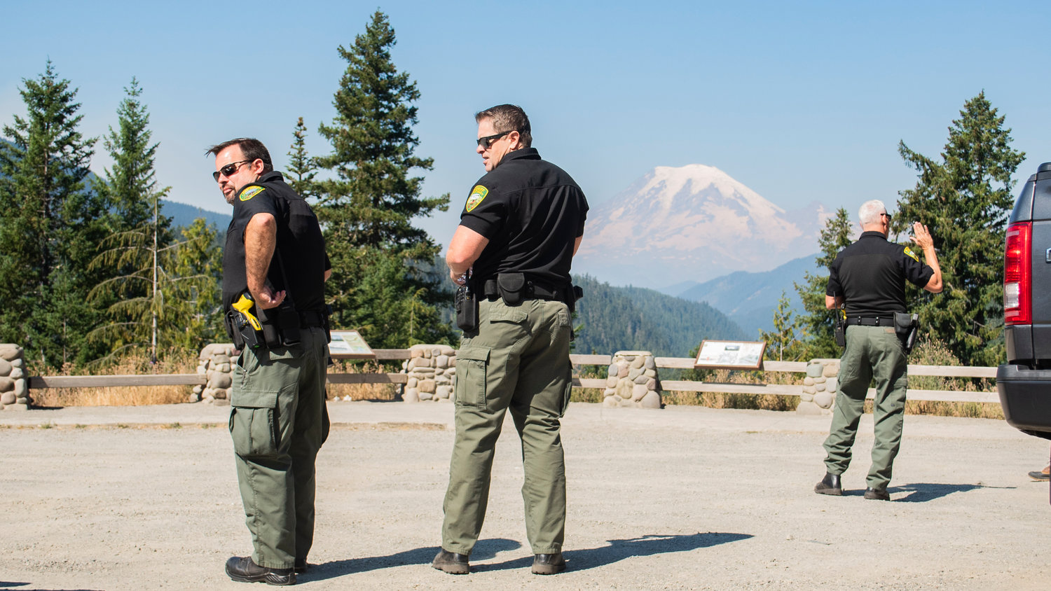
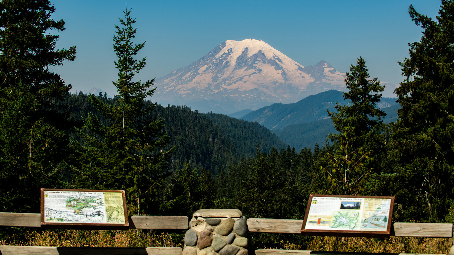
From left, Lewis County Sheriff’s Office Field Operations Chief Dusty Breen, Captain Rick Van Wyck and Sheriff Rob Snaza stand at a lookout off U.S. Highway 12 near White Pass as smoke from the Goat Rocks Fire shrouds the bottom of Mount Rainier.
Isabel Vander Stoep / isabel@chronline.com
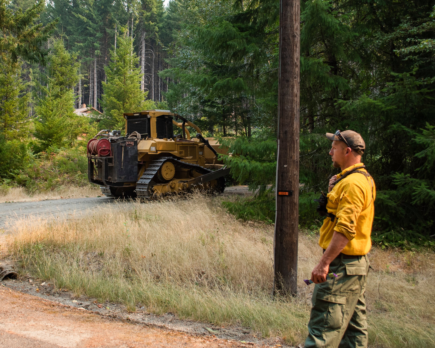
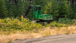
Bulldozers are used in Timberline to create a buffer zone between forests and neighborhoods as the Goat Rocks Fire blaze on Saturday afternoon was about a mile from structures in the area.
Isabel Vander Stoep / isabel@chronline.com
Smoke pours into the Big Bottom Valley from the Goat Rocks Fire on Saturday afternoon.
Isabel Vander Stoep / isabel@chronline.com
Bulldozers are driven through Timberline to create a buffer zone between forests and neighborhoods as the Goat Rocks Fire blaze on Saturday afternoon was about a mile from structures in the area.
Isabel Vander Stoep / isabel@chronline.com
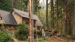
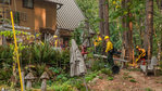
Firefighters from local agencies across Washington state work to create defensible space between trees and homes inside the Timberline neighborhood east of Packwood Saturday.
Isabel Vander Stoep / isabel@chronline.com
Lewis County Sheriff Rob Snaza describes movement of smoke from the Goat Rocks Fire during a Saturday ridealong where he and staff from his office surveyed the various neighborhoods affected by evacuation orders.
Isabel Vander Stoep / isabel@chronline.com
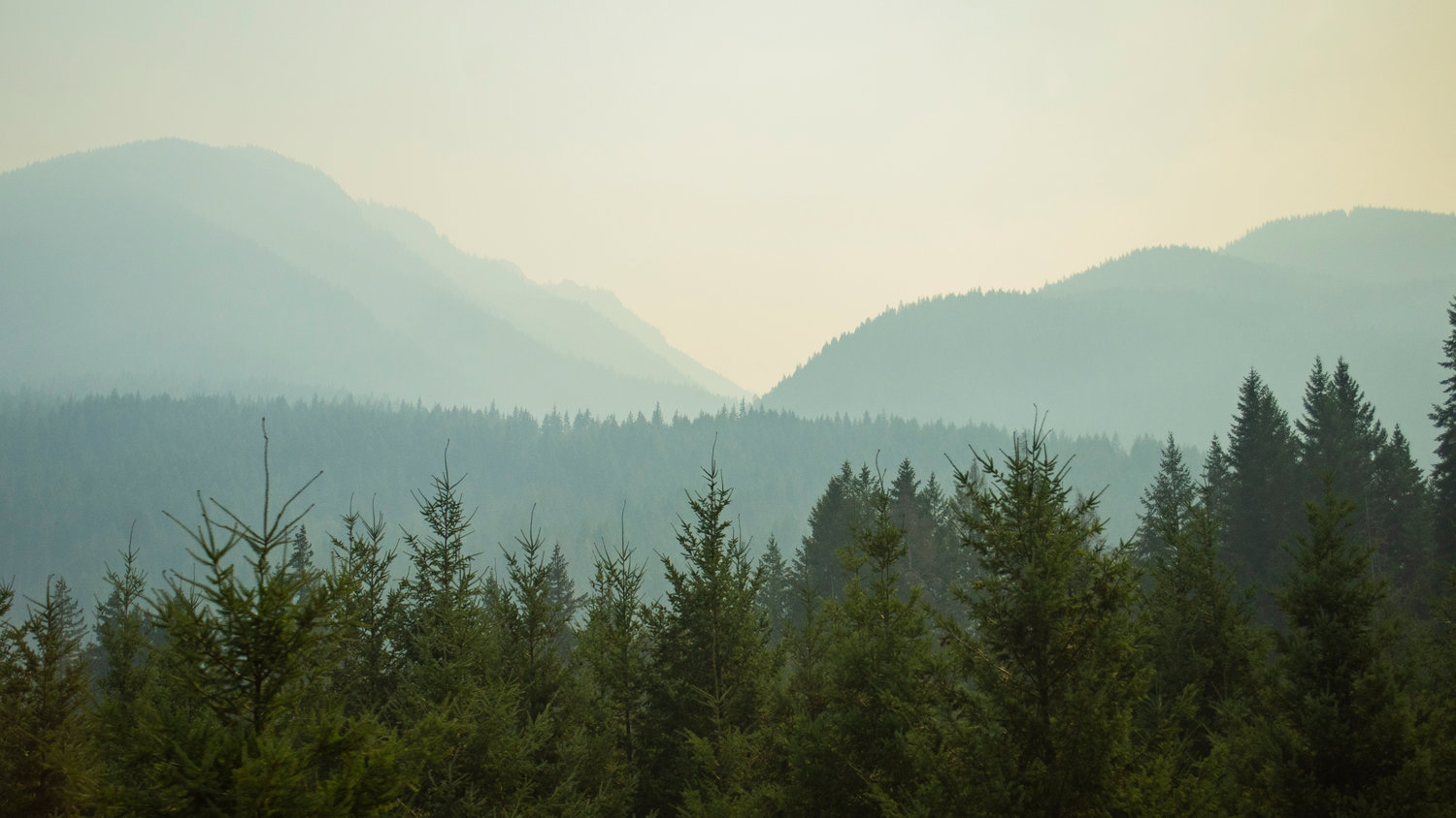
Smoke from the Goat Rocks Fire billows over the hills seen from between White Pass and Packwood on U.S. Highway 12 on Saturday afternoon.
Isabel Vander Stoep / isabel@chronline.com
Smoke from the Goat Rocks Fire drifts over foothills of Mount Rainier seen Saturday morning from a viewpoint along U.S. Highway 12.
Photos By Jared Wenzelburger / jared@chronline.com
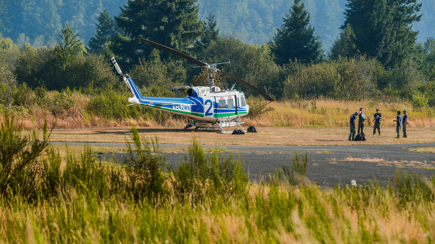
Department of Natural Resources helicopters are seen grounded at the Strom Field Airport in Morton due to high winds Saturday morning.
Photos By Jared Wenzelburger / jared@chronline.com
Lewis County Sheriff Rob Snaza stares at a column of smoke rising from the Goat Rocks Fire Saturday afternoon along U.S Highway 12.
Photos By Jared Wenzelburger / jared@chronline.com
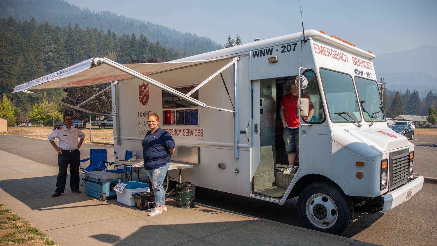
The Salvation Army Emergency Services van is seen parked at the White Pass Elementary School Saturday morning in Randle.
Photos By Jared Wenzelburger / jared@chronline.com
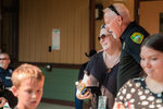
Gin and Steven Pack smile while greeting visitors and cleaning up after serving meals with The Salvation Army at an American Red Cross site at the White Pass Elementary School Saturday morning in Randle.
Photos By Jared Wenzelburger / jared@chronline.com
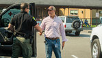
Lewis County Sheriff Rob Snaza embraces Rieva Lester at an American Red Cross site at the White Pass Elementary School Saturday morning in Randle.
Photos By Jared Wenzelburger / jared@chronline.com
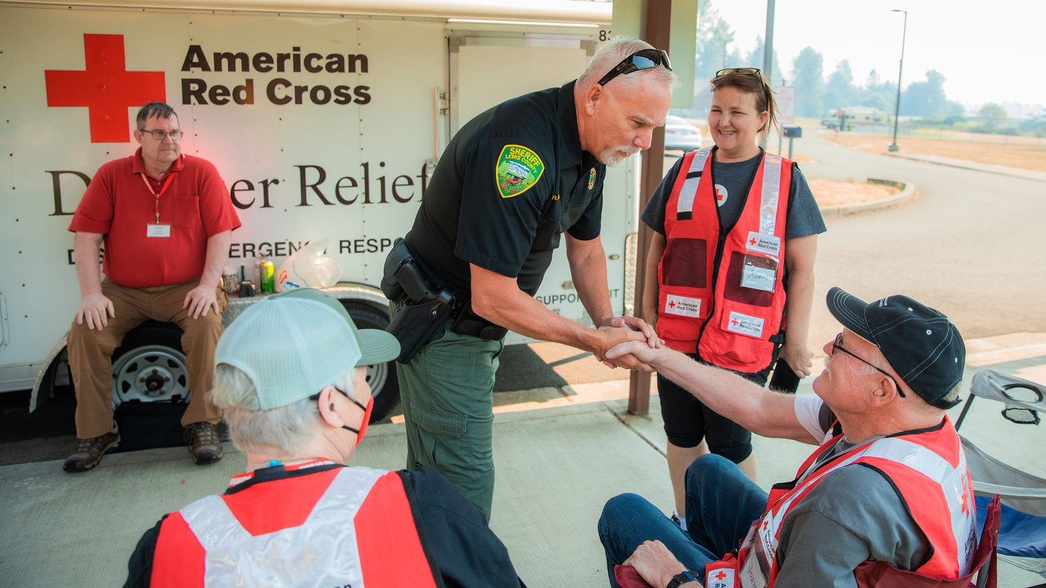
Lewis County Sheriff Rob Snaza shakes hands with workers at an American Red Cross site at the White Pass Elementary School Saturday morning in Randle.
Photos By Jared Wenzelburger / jared@chronline.com
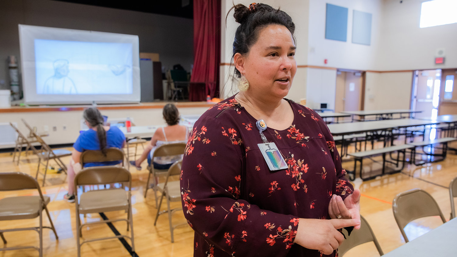
Interim Director Meja Handlen, with Lewis County Public Health & Social Services, talks about visitors at an American Red Cross site located at White Pass Elementary School Saturday morning in Randle.
Photos By Jared Wenzelburger / jared@chronline.com
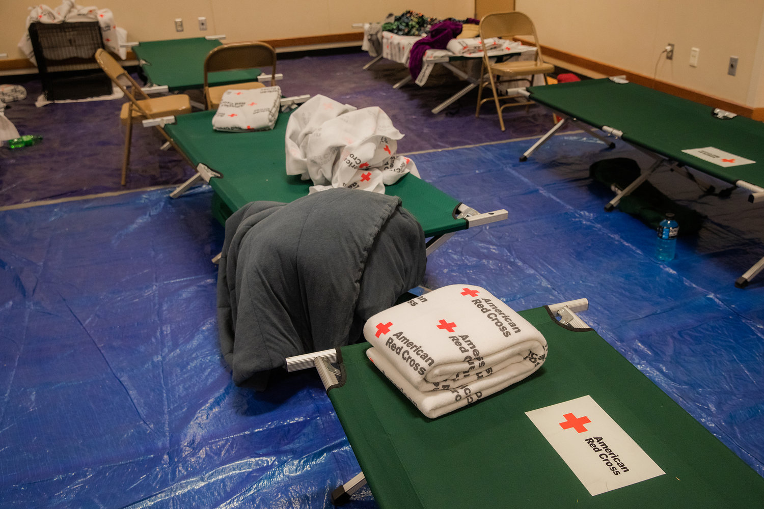
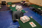
Cots are arranged with American Red Cross blankets at the White Pass Elementary School Saturday morning in Randle.
Photos By Jared Wenzelburger / jared@chronline.com
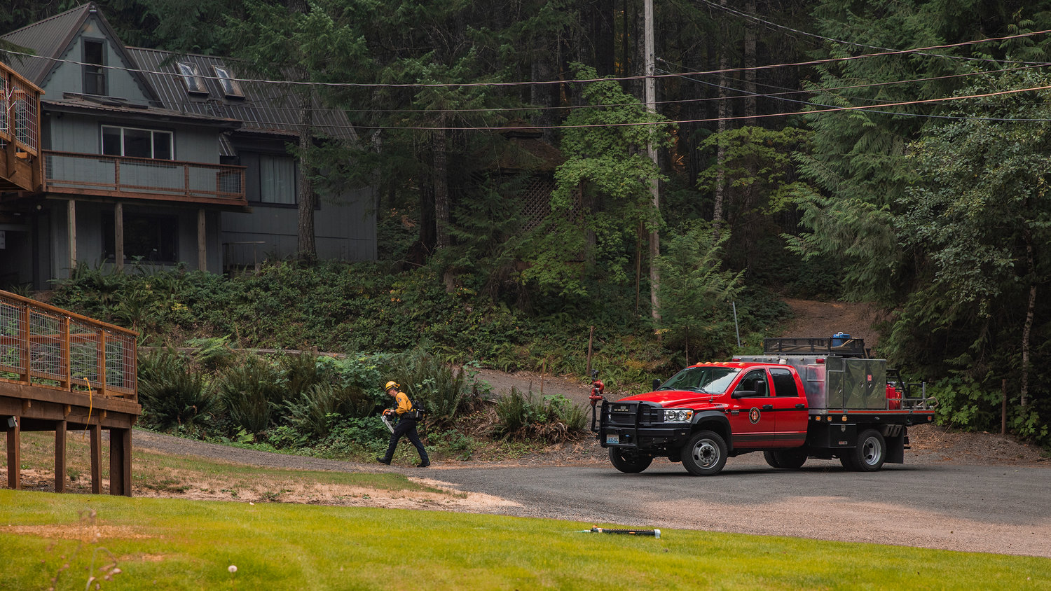
A West Thurston firefighter conducts structural triage in the Timberline area Saturday afternoon in Packwood.
Photos By Jared Wenzelburger / jared@chronline.com
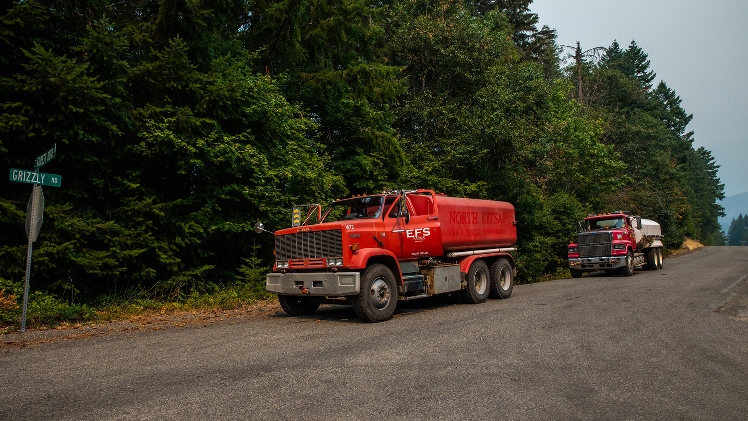
Firefighters sit on standby while working along Grizzly Road Saturday afternoon in Packwood.
Photos By Jared Wenzelburger / jared@chronline.com
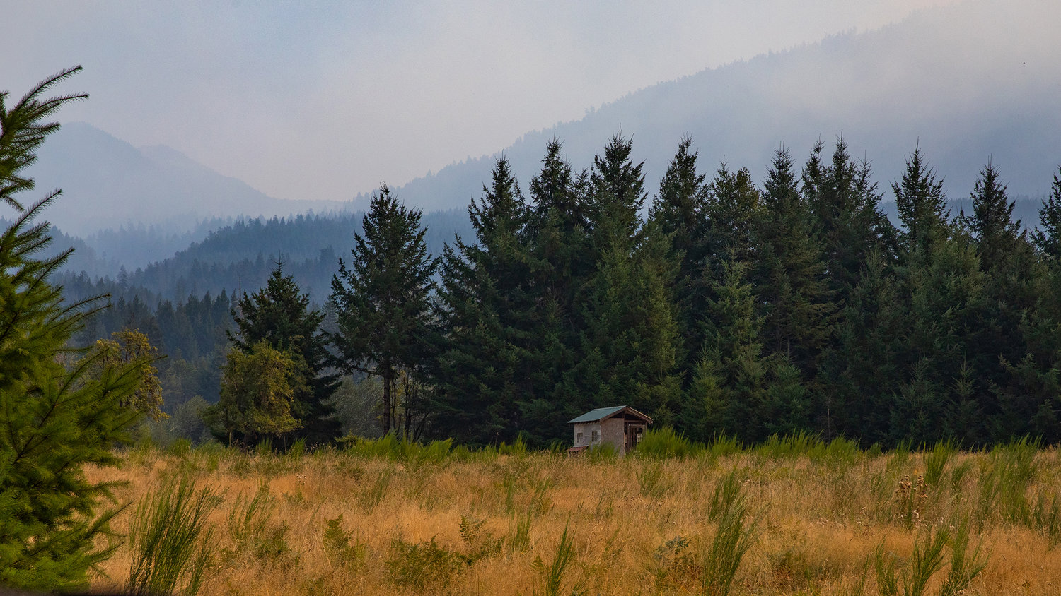
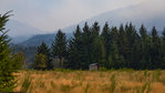
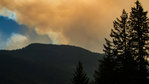
Smoke from the Goat Rocks Fire surrounds High Valley Saturday afternoon in Packwood.
Photos By Jared Wenzelburger / jared@chronline.com
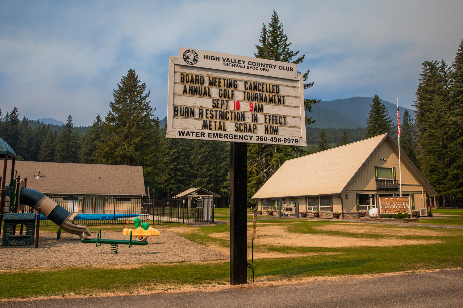
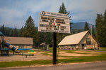
Smoke is seen from the High Valley Country Club Saturday afternoon in Packwood.
Photos By Jared Wenzelburger / jared@chronline.com
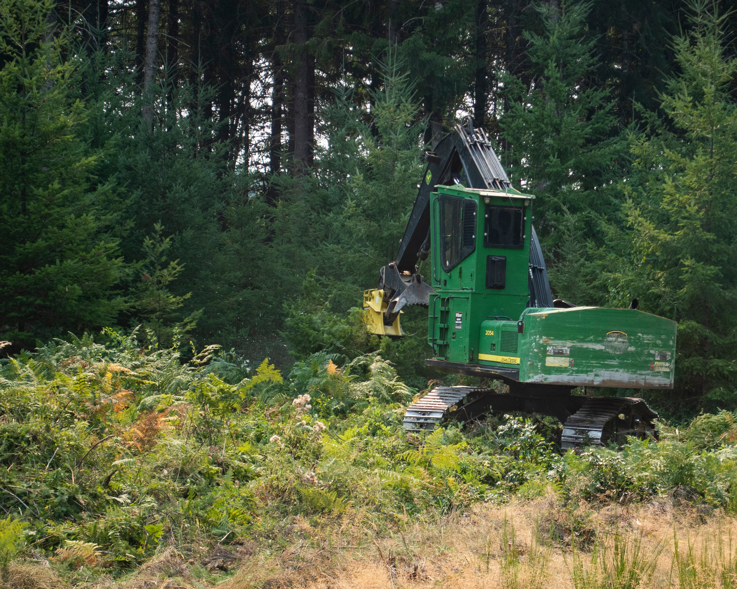
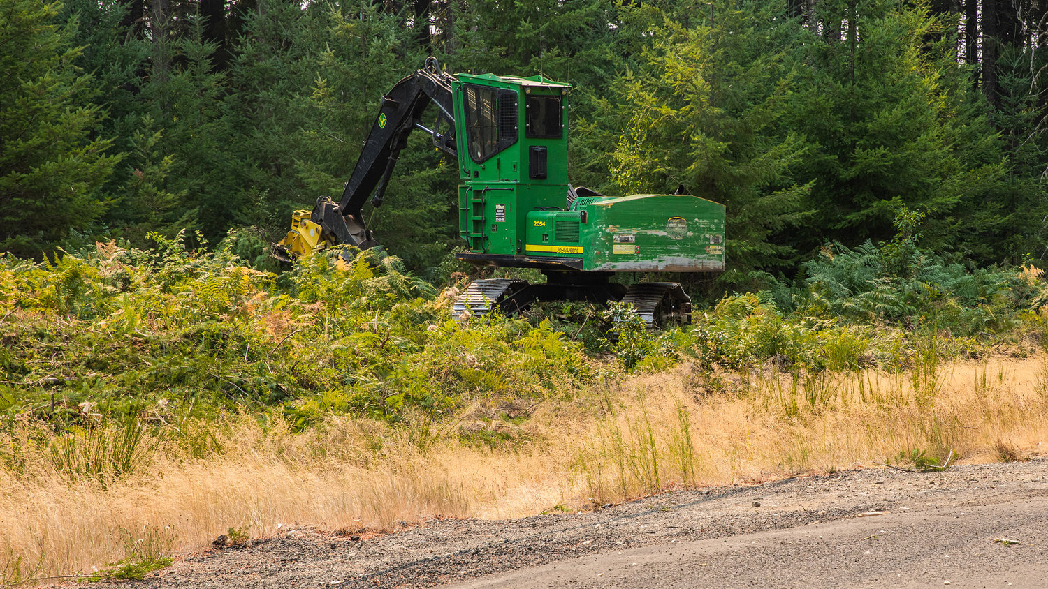
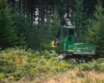
Heavy equipment is used to dig fire lines in the Timberline area on Saturday in Packwood.
Photos By Jared Wenzelburger / jared@chronline.com
Dusty Breen, field operations chief with the Lewis County Sheriff’s Office, left, talks with firefighters as they use heavy equipment to dig fire lines in the Timberline area on Saturday in Packwood.
Photos By Jared Wenzelburger / jared@chronline.com
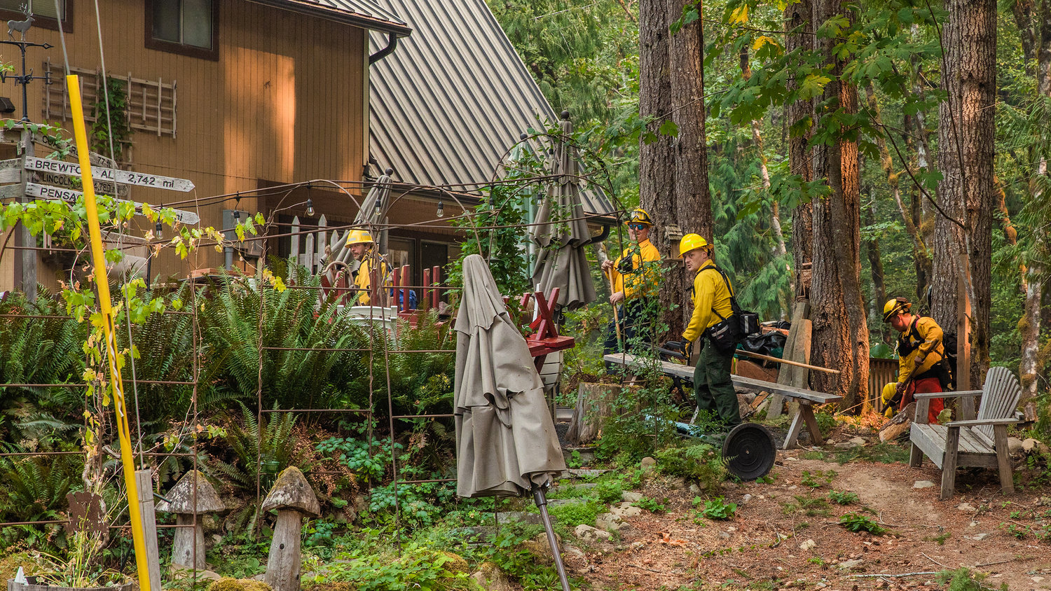
Firefighters conduct structural triage near structures in the Timberline area Saturday in Packwood.
Photos By Jared Wenzelburger / jared@chronline.com
Firefighters walk between structures in the Timberline area on Saturday near Packwood.
Photos By Jared Wenzelburger / jared@chronline.com
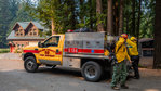
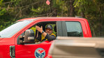
Crews from Clark County Fire District 10 remove gear from a truck while working near Timberline on Saturday in Packwood.
Photos By Jared Wenzelburger / jared@chronline.com
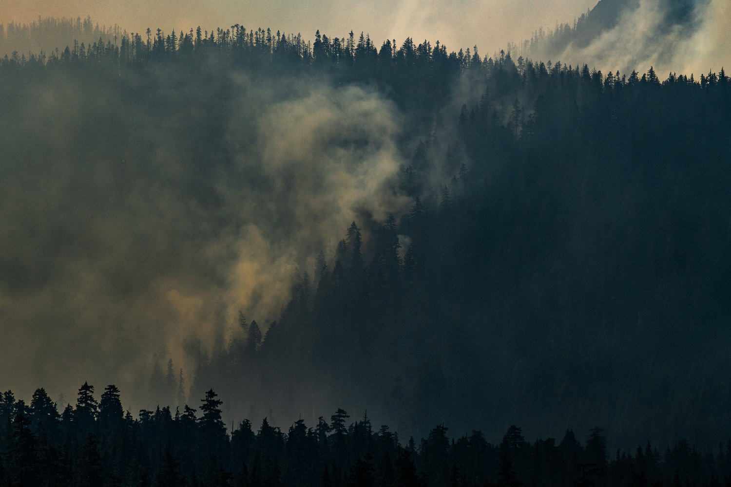
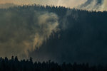
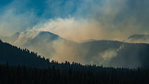
Smoke rises through trees as the Goat Rocks Fire continues on Saturday near Packwood.
Photos By Jared Wenzelburger / jared@chronline.com
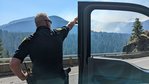
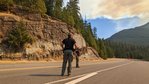
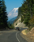
Sheriff Rob Snaza drives down U.S Highway 12 near Packwood on Saturday as Mount Rainier sets the backdrop.
Photos By Jared Wenzelburger / jared@chronline.com
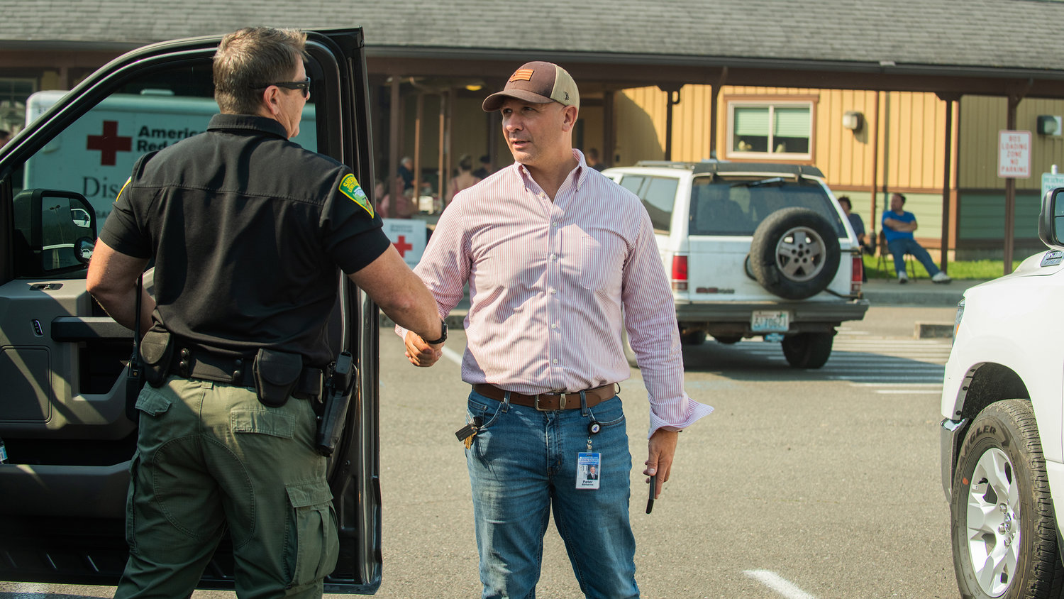
Captain Rick Van Wyck, with the Lewis County Sheriff’s Office, shakes hands with State Rep. Peter Abbarno outside an American Red Cross center at White Pass Elementary in Randle on Saturday.
Photos By Jared Wenzelburger / jared@chronline.com
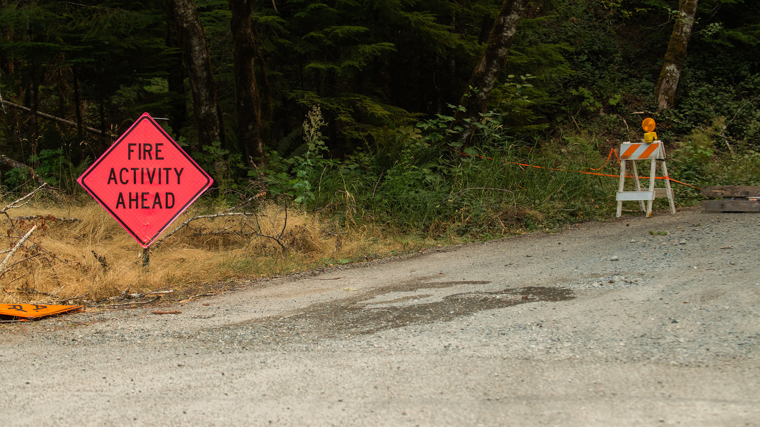
NF-46 remains closed for fire activity and staging.
Photos By Jared Wenzelburger / jared@chronline.com
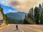
A column of smoke blocks out the sun along U.S Highway 12 near Packwood on Saturday.
Photos By Jared Wenzelburger / jared@chronline.com
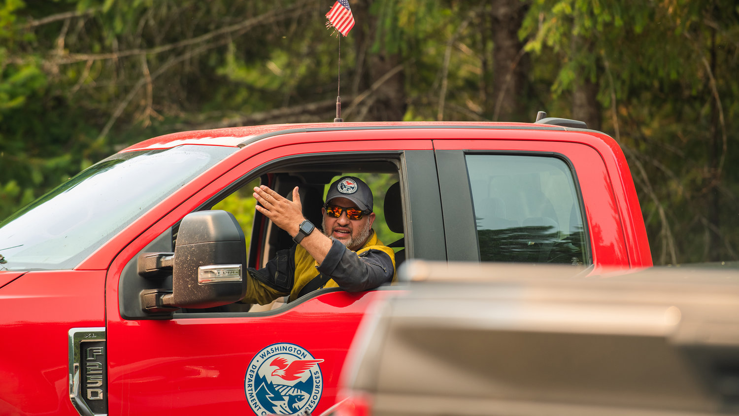
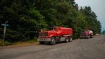
Department of Natural Resources crews patrol roads alongside members of the Lewis County Sheriff’s Office on Saturday along U.S Highway 12 near Packwood.
Photos By Jared Wenzelburger / jared@chronline.com
Smoke rises from the Goat Rocks Fire seen from U.S. Highway 12 on Saturday near Packwood.
Photos By Jared Wenzelburger / jared@chronline.com
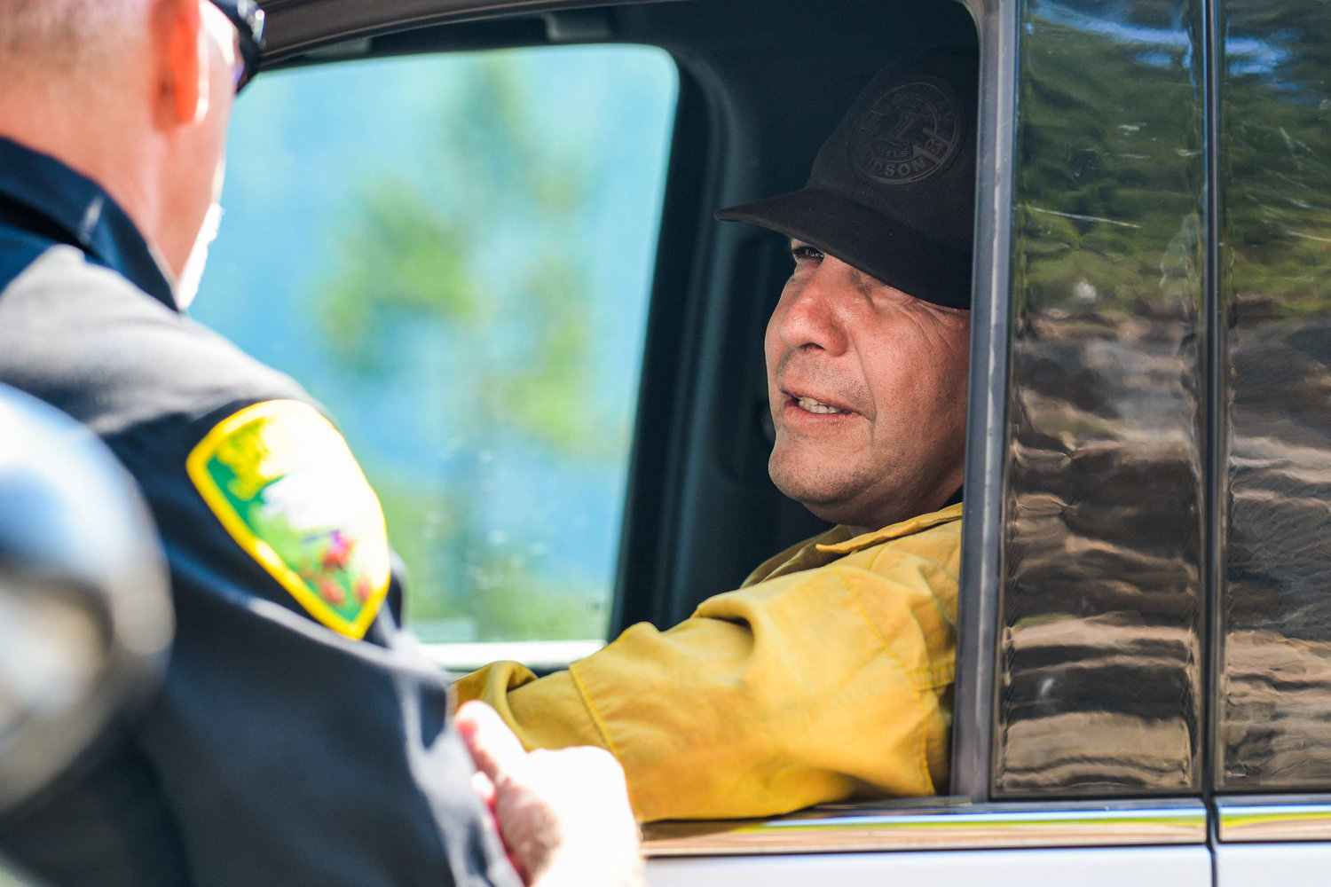
Lewis County Sheriff Rob Snaza talks with Rocky Ahshapanek, Incident Commander on the Goat Rocks Fire, on Saturday along U.S Highway 12 near Packwood.
Photos By Jared Wenzelburger / jared@chronline.com
Erika Katt, Lewis County emergency management planner, takes calls from Packwood residents asking for info on the Goat Rocks Fire.
Photos By Jared Wenzelburger / jared@chronline.com
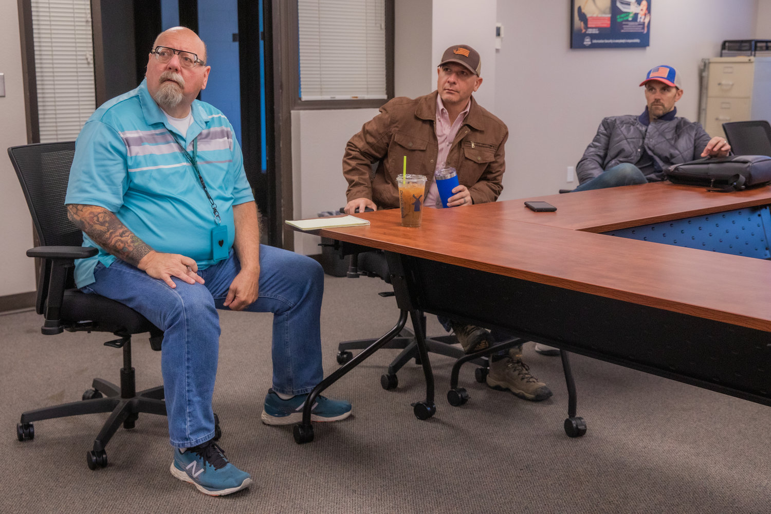
From left, Ross McDowell, Lewis County emergency management deputy director, State Rep. Peter Abbarno and Commissioner Sean Swope attend an update meeting on the Goat Rocks Fire situation Saturday morning at the Lewis County Courthouse in Chehalis.
Photos By Jared Wenzelburger / jared@chronline.com
From left, Ross McDowell, Lewis County emergency management deputy director, State Rep. Peter Abbarno and Commissioner Sean Swope attend an update meeting on the Goat Rocks Fire situation Saturday morning at the Lewis County Courthouse in Chehalis.
Photos By Jared Wenzelburger / jared@chronline.com
Ross McDowell, Lewis County emergency management deputy director, points to his computer screen while showing Erika Katt, Lewis County emergency management planner, wind conditions around the Goat Rocks Fire.
Photos By Jared Wenzelburger / jared@chronline.com
Ross McDowell, Lewis County emergency management deputy director, talks about the two hours between level 1 and level 3 evacuation orders for areas of Packwood affected by the Goat Rocks Fire.
Photos By Jared Wenzelburger / jared@chronline.com