


Goat Rocks Fire Central: This post will be updated with additional information throughout the course of the fire. To see more, follow The Chronicle on Facebook.
5 p.m. Saturday Update: Goat Rocks Fire Still Growing Saturday; More Wind, Heat in the Forecast
By Isabel Vander Stoep / isabel@chronline.com
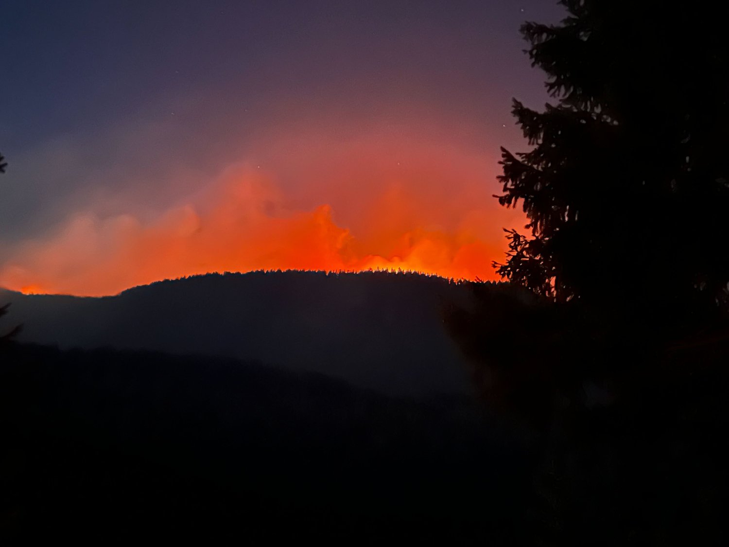
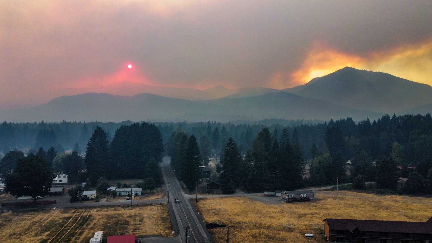
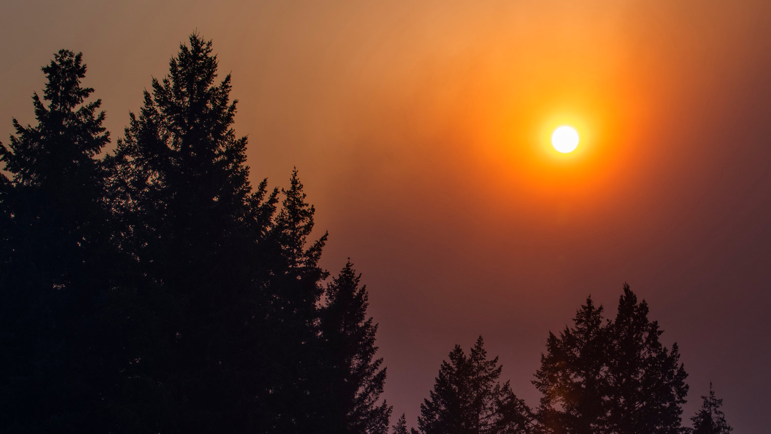
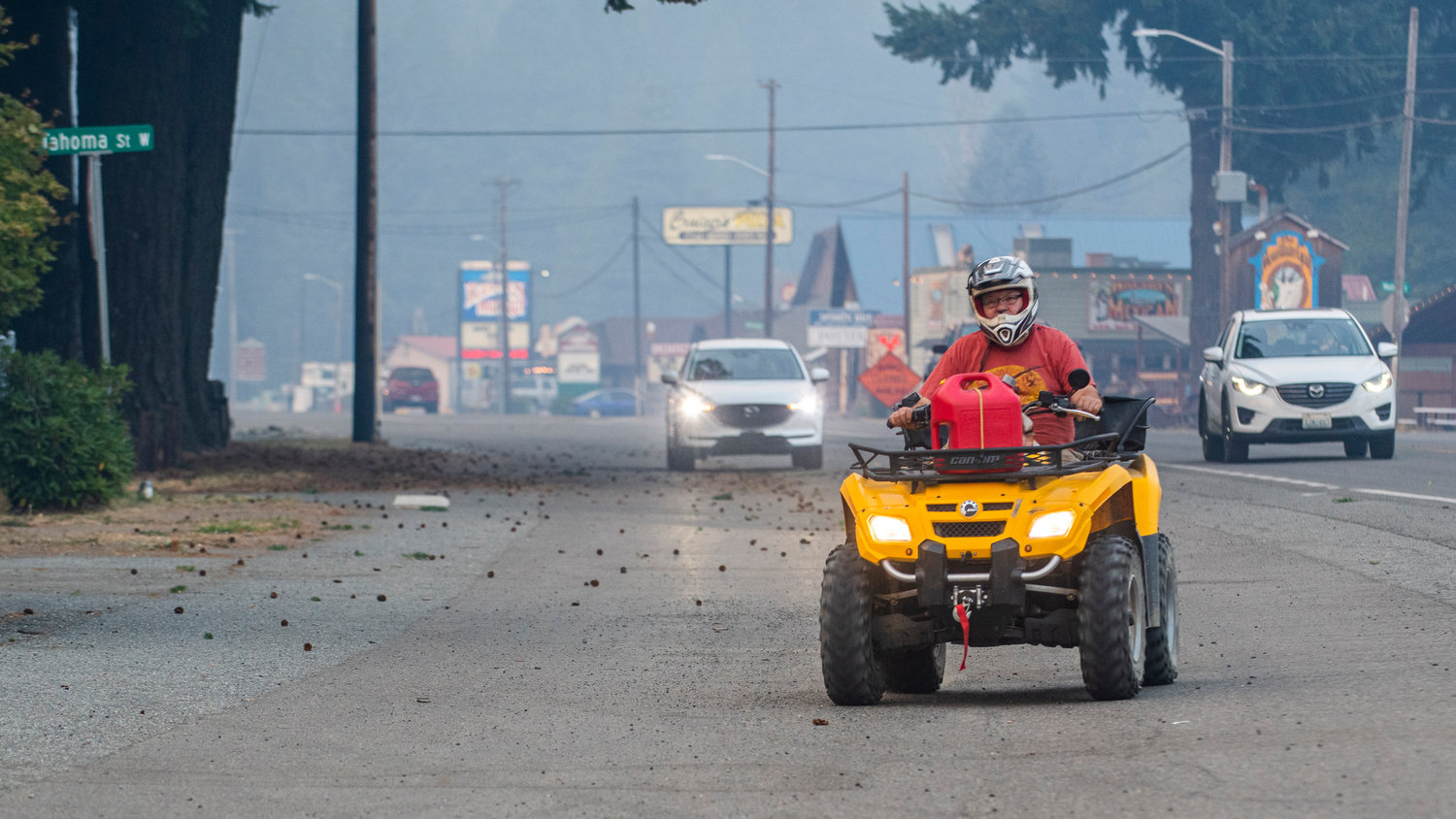
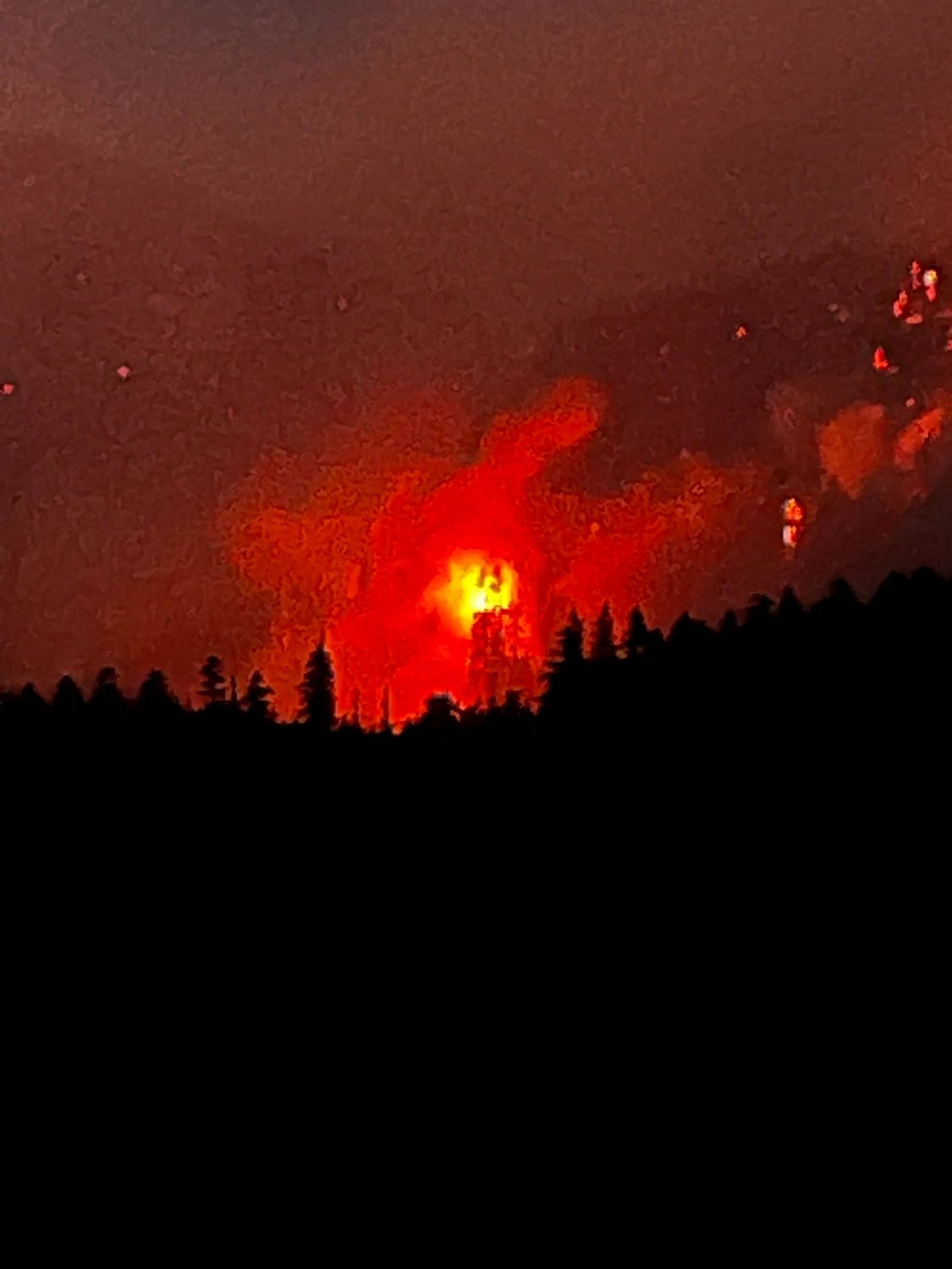
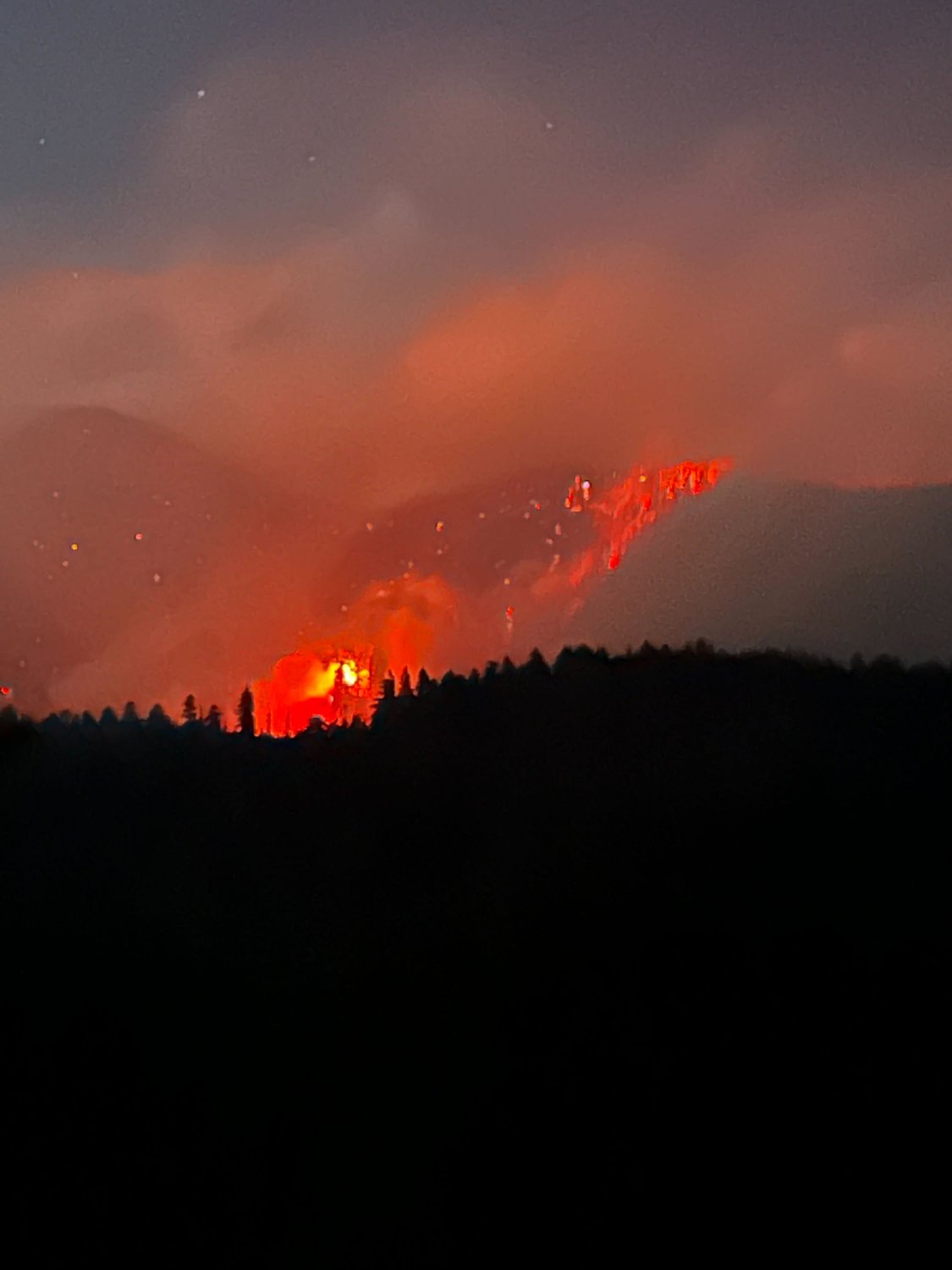
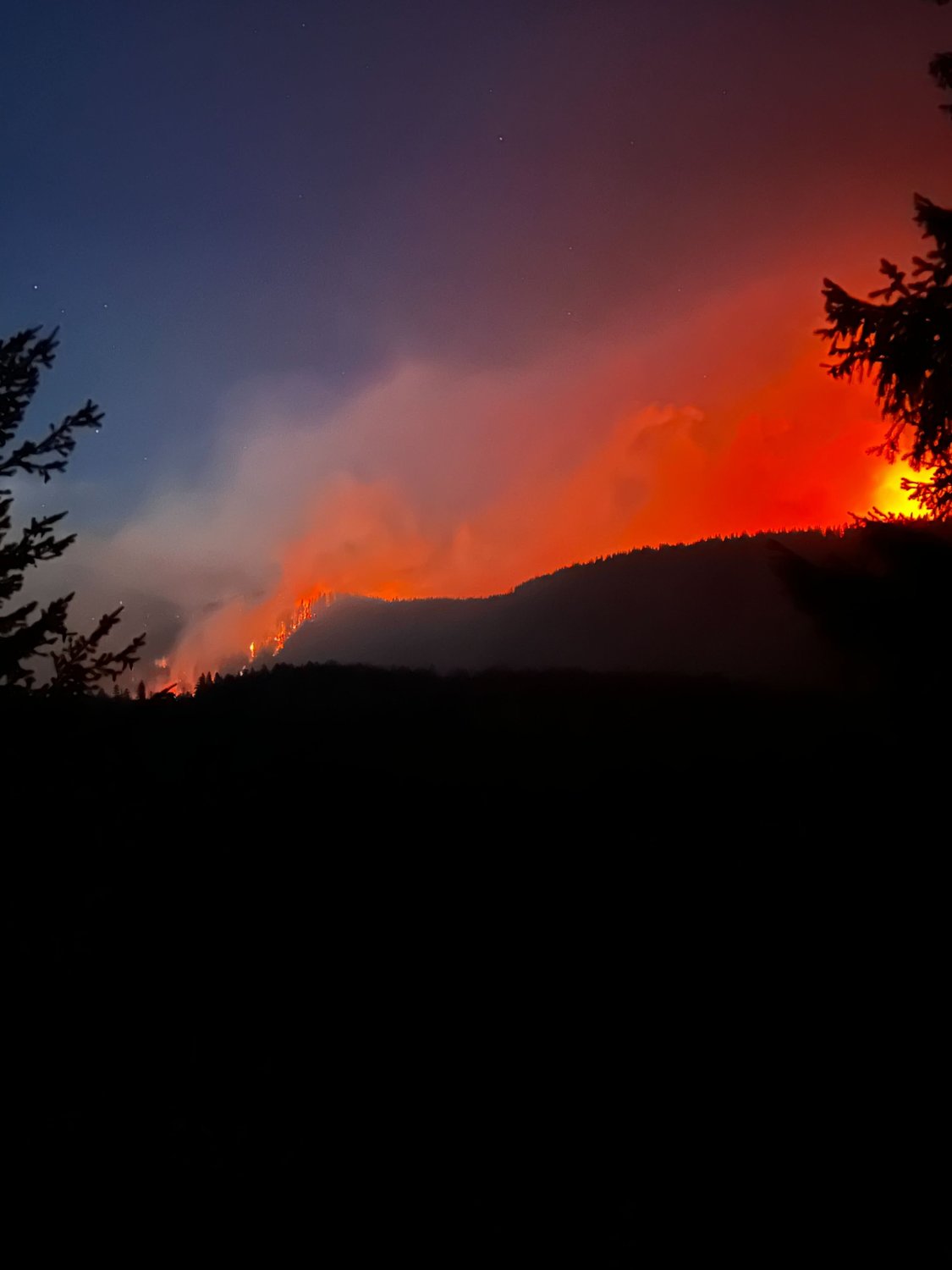
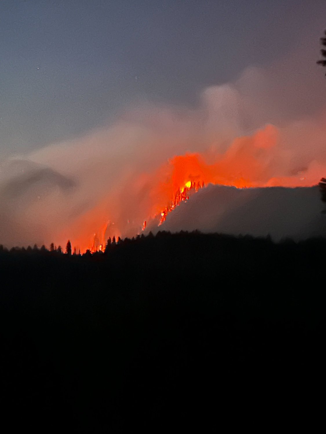
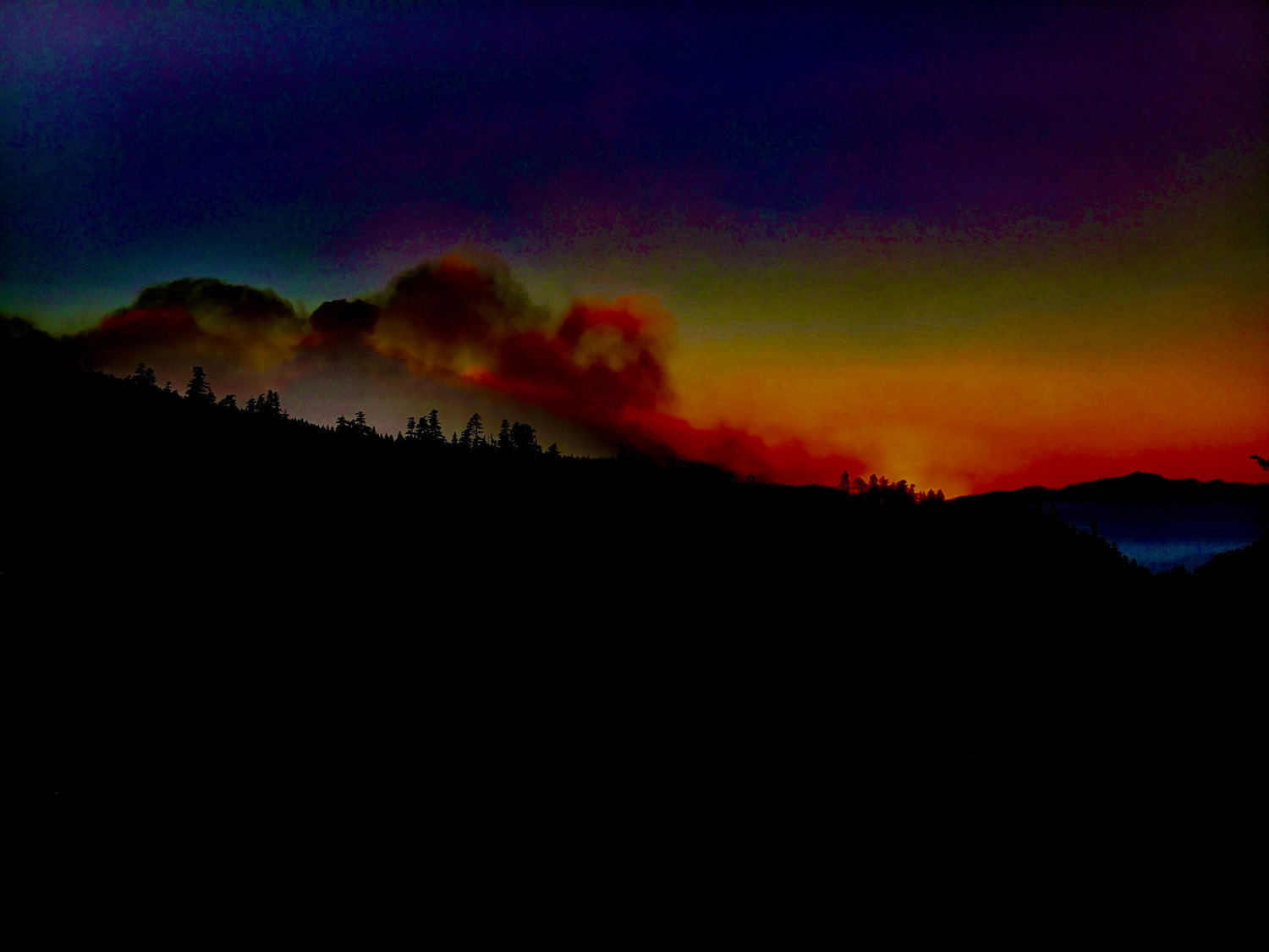
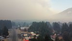
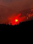
The Goat Rocks Fire is continuing to grow in the forest outside Packwood, Lewis County’s easternmost community. It had scorched 1,600-1,800 acres as of Saturday afternoon.
No injuries or structure damage have been caused by the fire as of the incident command team’s most recent update at around 3 p.m. Saturday.
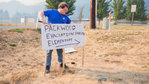
Evacuation orders that went into place on Friday will continue to be held until Sunday evening at the earliest. Currently, a level three, “GO” order is in place for several neighborhoods east of Packwood: Timberline, High Valley and Goat Rocks.
A level two, “get set” order is in place for Packwood proper, meaning there is “significant danger” to the area, per Lewis County’s Division of Emergency Management (DEM).
Fortunately, the fire growth throughout the day has been slower than growth on Friday. Windy, dry conditions are expected to remain throughout the night and into Sunday. Cooler, more humid weather is forecast for Monday, which would be of help to the multitude of agencies currently fighting the fire.
Currently, the fire is 1 mile from the Timberline neighborhood, 2 miles from Packwood Lake and 1 mile for U.S. Highway 12.
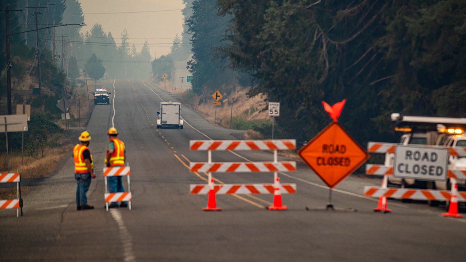
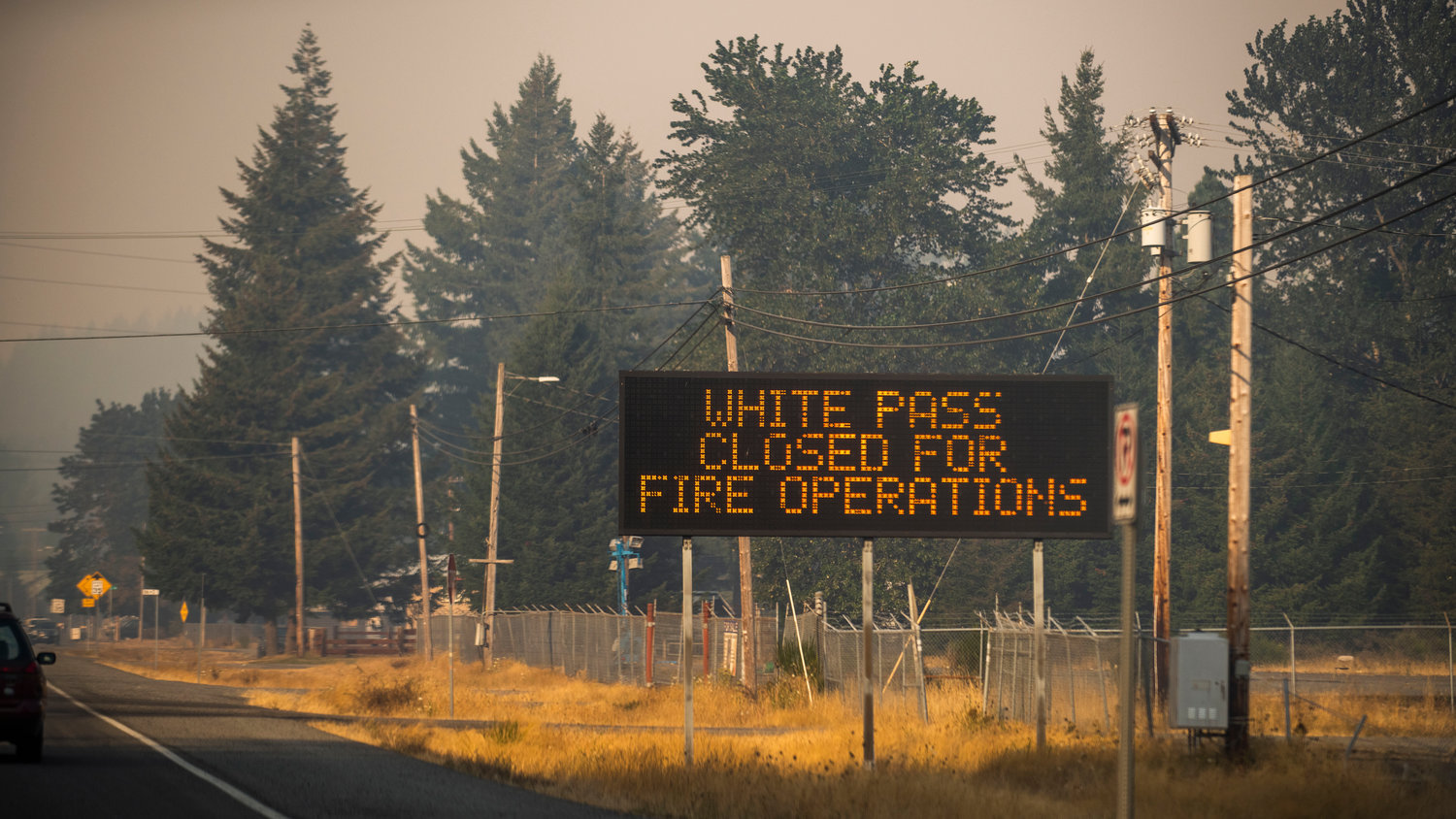
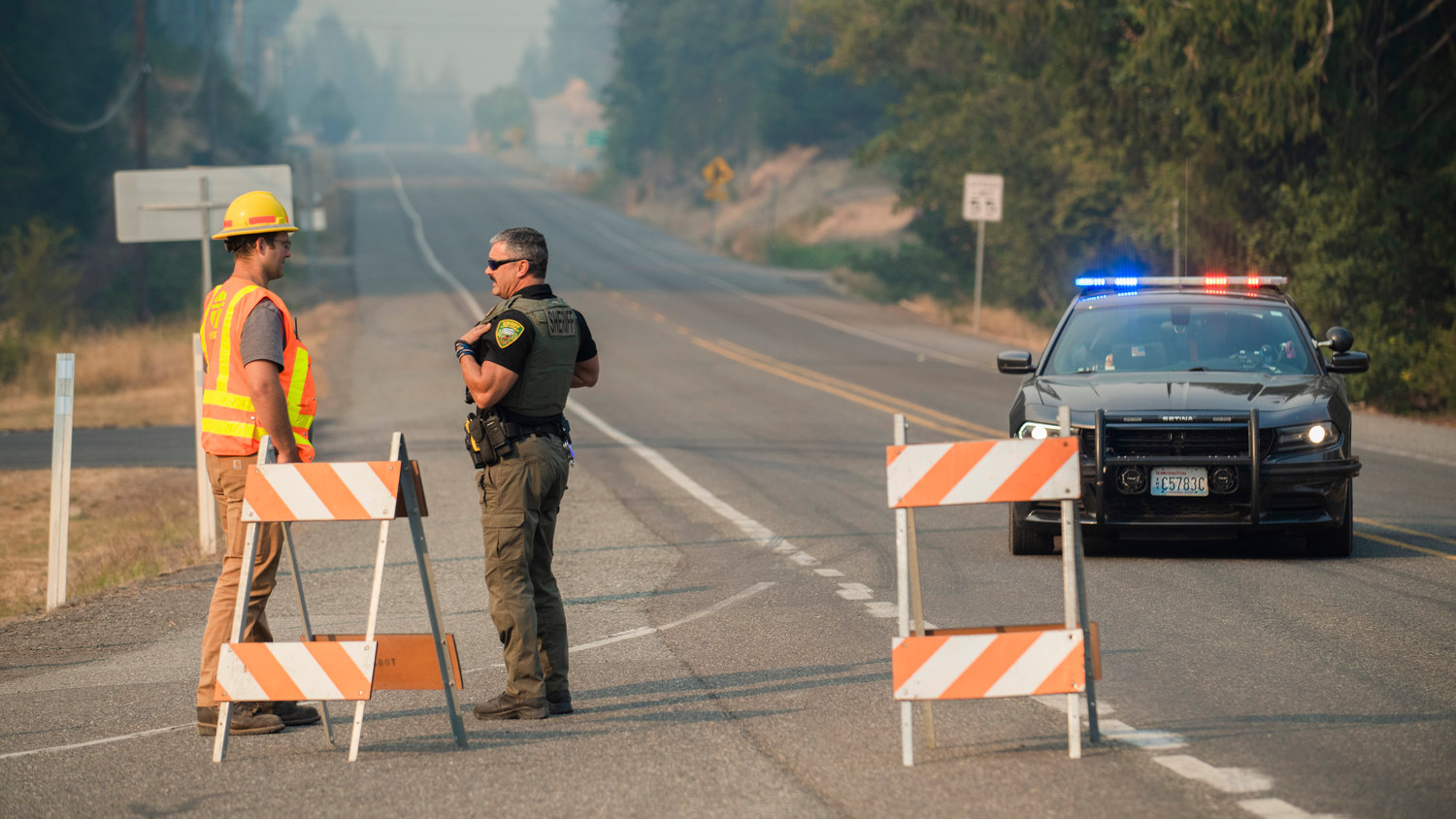
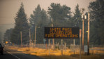
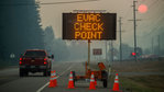
The highway remains closed between Skate Creek Road and White Pass.
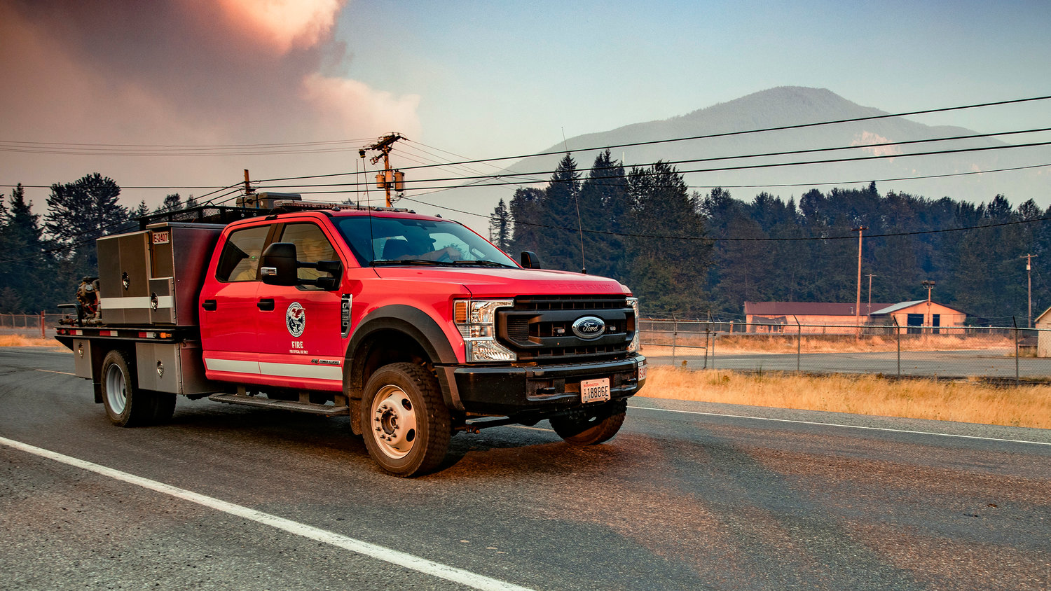
There are five helicopters and two 20-person hand crews working the fire..
“There is a trigger point for a ‘GO’ for Packwood and that is the third ravine right before Highway 12, if that catches fire. We can’t say (if or) when that’s going to be it’ll just be however the fire grows due to wind,” said Ross McDowell, deputy director of Lewis County’s Department of Emergency Management, adding that teams are holding out hope the fire will become easier to manage with better weather.
McDowell said winds are forecast to be 20 to 35 miles per hour overnight. The direction in which they blow will have the largest impact on the fire’s behavior.
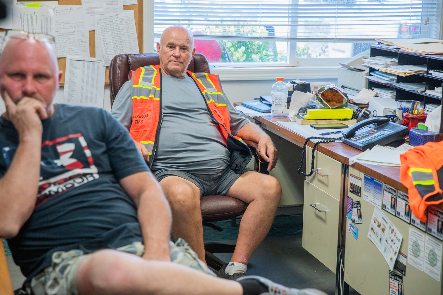
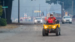
According to Adam Turner, U.S. Forest Service’s public information officer, around 500 residences in the three Packwood-area neighborhoods have needed to be evacuated. Law enforcement officers and firefighters are patrolling the evacuated areas to prevent potential crimes such as break-ins.
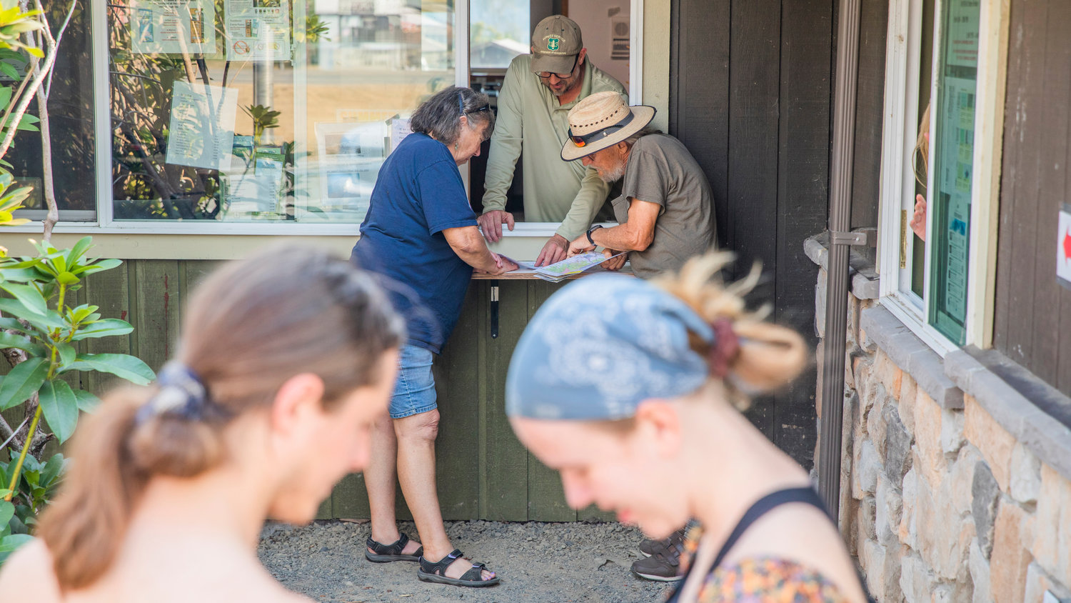
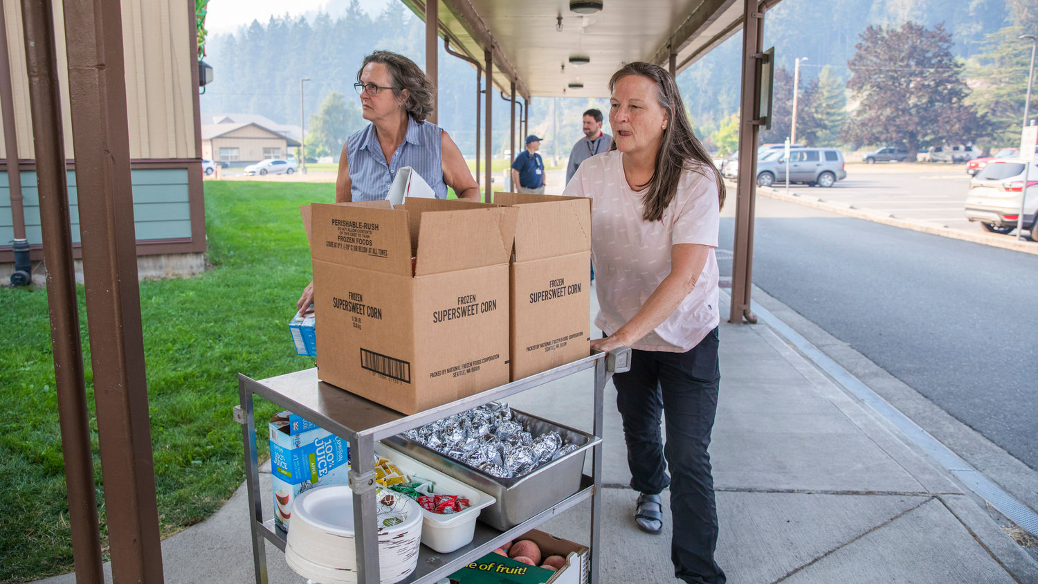
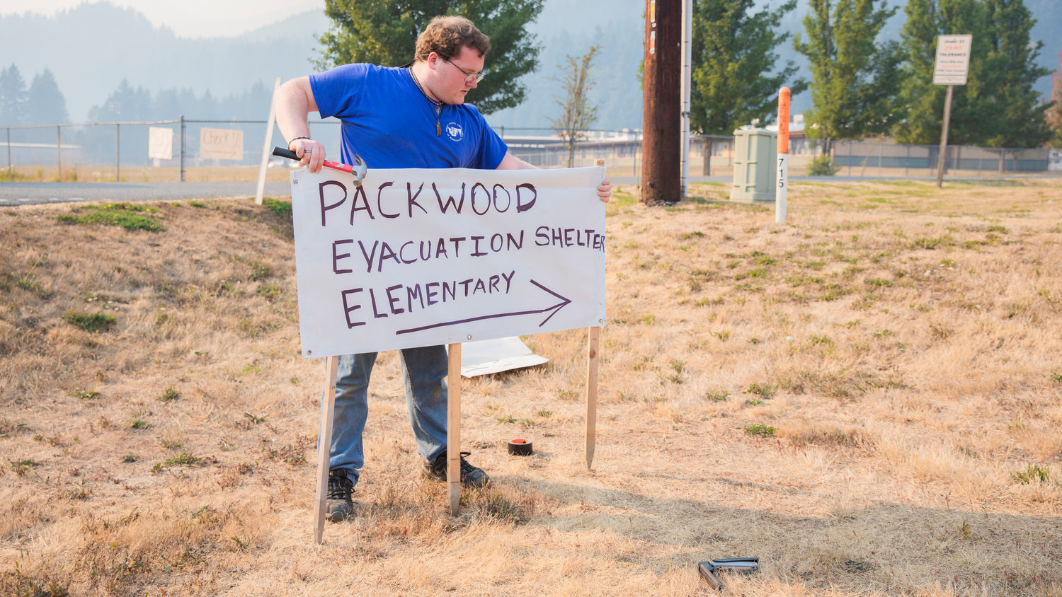
The White Pass School is hosting evacuees and serving meals made by the Salvation Army Centralia three times per day. Anyone who is at the shelter during meal time is welcome to the food, according to a staff member at the shelter on Saturday.
School will not be held on Monday. After that, the district will make calls on a day-by-day basis. Sports schedules are also set to change, with Morton-White Pass’ Monday night football has been postponed to Tuesday while volleyball is indefinitely suspended.
For more tips or to sign up for Lewis County Alert in order to receive evacuation notices, visit https://lewiscountywa.gov/departments/emergency-management/.
For more on the fire, visit, https://www.fs.usda.gov/detail/giffordpinchot/news-events/?cid=FSEPRD1059368&fbclid=IwAR3y7zgfmj9IcZdbvZNpUK0ikrYt1XVSREOStcP7cagBaWGaJYMaK8FcSfw.
3:30 p.m. Saturday Update: U.S. Highway 12 to Remain Closed Through Weekend Due to Goat Rocks Fire
Both directions of U.S. Highway 12 between Skate Creek Road in Packwood and the White Pass summit will remain closed through the weekend due to the Goat Rocks Fire, according to the Washington State Department of Transportation.
Southbound state Route 123 is also closed to through traffic accessing U.S. Highway 12.
The highway was closed Friday as the fire exploded in size, leading to evacuations in some areas.
Travelers are asked to avoid the area to provide access for emergency vehicles supporting firefighting efforts.
Stevens Canyon Road and Ohanapecosh Campground remain open. Commercial vehicles are prohibited in the Mount Rainier National Park.
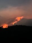
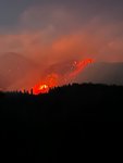
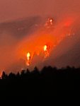
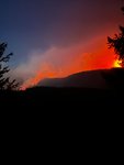
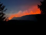
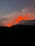
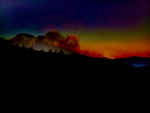
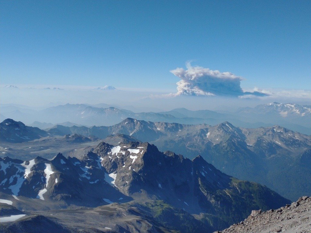
12:45 p.m. Saturday: Goat Rocks Fire in Focus
12:20 p.m. Saturday Update: From Lewis County PUD
"At approximately noon PUD will be taking an outage to de-energize lines along Hwy 12 to the Timberline and Goat Rocks areas. This outage will allow fire crew machinery to move in and clear a fire break near our lines along the SE Side of Hwy 12 and Thompson Rd.
"We hope to restore power after the fire line has been established. The construction of the fire line requires tree falling and large equipment so this is out of caution that we will de-energize the line. During the outage, we will be interrupting power to about 375 customers.
"We will continue to coordinate with fire and emergency management agencies and try to minimize the duration of this outage which is needed to prevent the fire from breaching Hwy 12."
Please follow local evacuation orders and be safe. Fire updates can be found at https://lewiscountywa.gov/departments/emergency-management/.
11:45 a.m. Saturday Update: Battle Against Goat Rocks Fire Enters New Phase
Here's the latest update on the Goat Rocks Fore from the U.S. Forest Service:
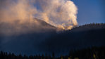
Overview: Located 2 miles NE of Packwood, WA in the Goat Rocks Wilderness on the Cowlitz Valley Ranger District. The Goat Rocks Fire is estimated to be 1500 acres in size. The incident was discovered on Aug. 9, 2022 and was partly suppressed by a rappel attack crew. Crews suppressed what they safely could and the fire was monitored. On September 9, 2022 the fire began to increase in size during a high wind event.
Size: Approximately 1500 acres
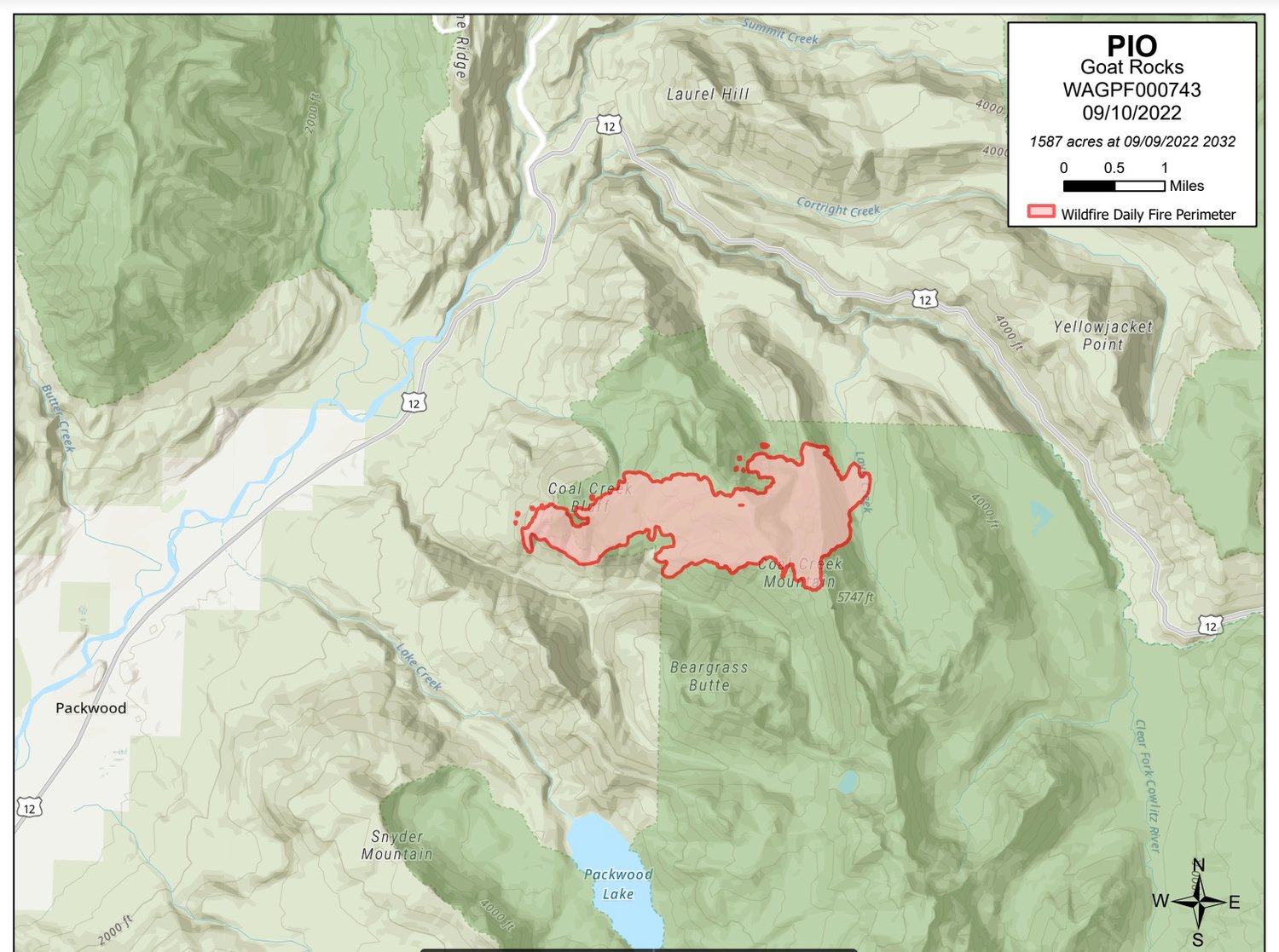
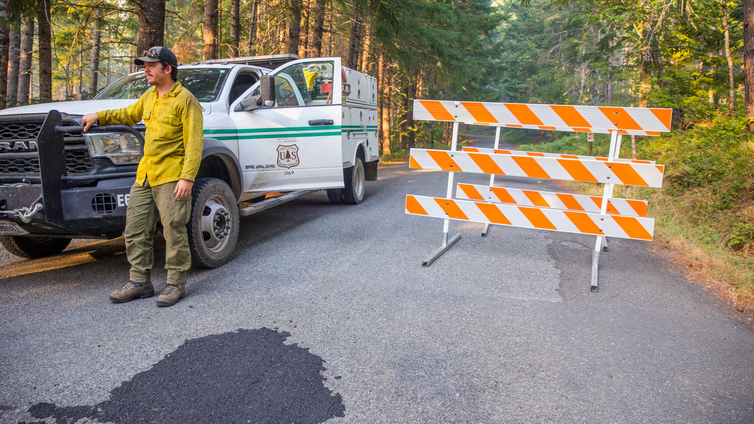
Forest closures: US Hwy-12 is closed from Skate Creek and White Pass. Highway 123 is closed from US Hwy 12 to Ohanapecosh Visitor center in Mount Rainier National Park. Forest Rd. Additionally, 4600, 4610, 4612 and all connected spurs, and Trail #65 to Bluff Lake.
Evacuations: Currently Timberline, Goat Rocks, and High Valley neighborhoods east of Packwood are under a level 3 evacuation, or Go status, and are required to evacuate. The remainder of the neighborhoods and businesses in Packwood is currently under a level 2 evacuation, or Set status, and should be prepared to evacuate. Evacuees should head to the White Pass School, located at 516 Silverbrook Road in Randle. Small animals are welcome at the school in a kennel or cage. Large animals are all sheltered at this time and there is no need for more assistance with these creatures.
Cause: Lightning
Fire Operations: Last night crews patrolled all the evacuated neighborhoods monitoring for any potential fires that were in the area. There was a small fire located near the High Valley community, but it was quickly suppressed. It is unknown at this time if that fire is related to the Goat Rocks incident or if it was a new start. Resources are continuing to work in and around these structures building a plan and preparing the areas in case the fire does make another push in that direction.
Additionally, an Infrared flight went over the fire last night and mapped the fire at 1500 acres, increasing the overall acreage due to better mapping. This data allows crews to have a better idea of the exact location of the fire currently and can begin taking action to slow further fire growth.
This morning crews are utilizing aircraft where they can to slow fire growth and lower fire intensity before weather conditions deteriorate. As wind speeds increase aircraft become less effective and conditions become difficult and dangerous to fly in. Once those winds pick up aircraft will return to their bases for safety. Additional resources arrived this morning and they are working to continue identifying and constructing fire breaks where they safely can.
Weather: There is a red flag warning that remains in effect through 7pm Sunday September 11. Continued high temperatures, low humidity, and winds out of the east gusting up to 35 mph will continue critical fire weather conditions. All these conditions are conducive for additional fire growth over the next 48 hours. Weather conditions are forecasted to moderate Sunday afternoon, providing an opportunity for fire crews to begin getting a handle on this incident.
Fire Restrictions: Campfire bans, and other use restrictions are in place across the Gifford Pinchot National Forest and much of the region.
Forest Web Site: Go to https://inciweb.nwcg.gov/incident/8415/ to view closure map and latest news. Fire Information Email: 2022.goatrocks@firenet.gov
11:30 a.m. Saturday Update:
8 a.m. Saturday Update:
11:20 p.m. Friday Update: White Pass School in Randle Hosts Goat Rocks Wilderness Fire Evacuees Overnight as State Mobilizes
By Emily Fitzgerald / emily@chronline.com
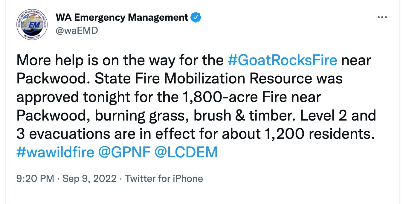
Aid from around Washington will soon head toward the Goat Rocks Wilderness fire near Packwood as the fire’s estimated size now sits at 1,800 acres, the state Department of Emergency Management announced Friday night.
The state approved activation of the State Fire Mobilization Resource, which puts out a call to any fire agencies in the state with resources to spare. The resource provides personnel, equipment and other logistical resources when a wildland fire or other emergency exceeds the firefighting capacity of local jurisdictions, according to a statement on the Washington State Patrol’s website.
Previous reports estimated the fire at 850 acres in size. The U.S. Forest Service reported the fire was just 80 to 90 acres on Wednesday.
Level three evacuations for the Timberline, High Valley and Goat Rocks communities east of Packwood, as well as level two evacuations for the town of Packwood itself, remained active Friday night.
The evacuations affect about 1,200 residents total, according to the state Department of Emergency Management.
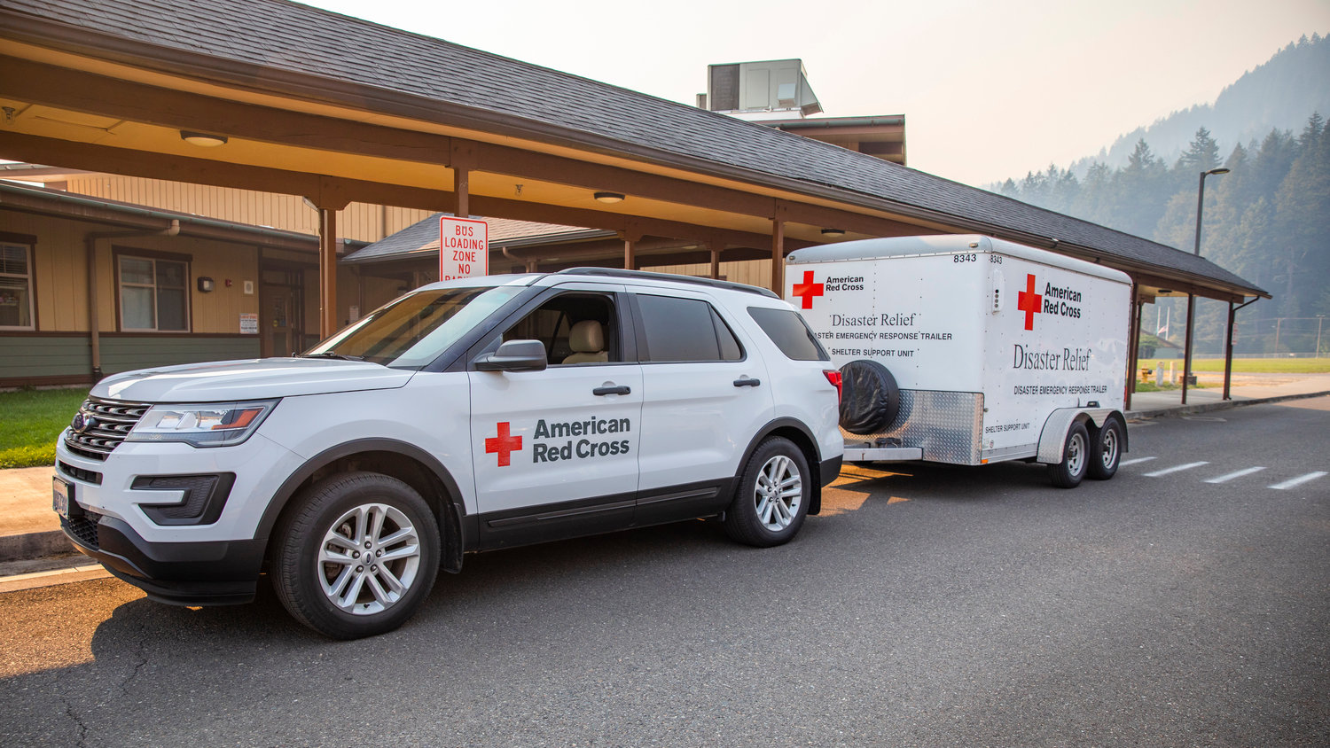
Of those, roughly 15 planned to stay overnight at White Pass Jr./Sr. High School, where volunteers with Lewis County and the American Red Cross set up an evacuation shelter.
An additional 18 planned to camp out in their cars parked at the property.
“The school district: fantastic,” Meja Handlen, deputy social services and operations director for Lewis County, told a Chronicle reporter on Friday. “They said ‘use the facility as needed,’ so that’s been really fantastic.”
Many of the Packwood area residents staying the night at White Pass School are neighbors, and huddled up in a loose circle to share food and conversation Friday night.
One evacuee, who has resided in the area for 55 years, told a Chronicle reporter she had left her residence near Timberline at 1:20 p.m. that afternoon to find ash already covering her car.
They talked of their anxieties and their sorrow over the fire potentially damaging their homes, but mostly they expressed gratitude that they and their loved ones were safe.
When Lewis County Emergency Management issued the evacuation orders Friday afternoon, Lewis County Health & Social Services had personnel out to the school within two hours, said Handlen. The American Red Cross had personnel and volunteers out within four.
The Lewis County Animal Shelter has provided food and kennels for any of the evacuees’ pets and the Salvation Army stepped up to feed the people staying at the school.
Around 8 p.m. on Friday, Salvation Army captains Steven and Gin Pack arrived at the school with 82 hot meals, 500 bottles of water and 170 hygiene packs.
The Salvation Army planned to bring additional supplies on Saturday.
10:30 p.m. Friday Update: Forest Service Provides Update on Goat Rocks Fire:
Washington Emergency Management has said the Goat Rocks Fire is now at 1,800 acres, though the latest update from the U.S. Forest Service has the blaze at 1,200 acres.
Here’s the latest information from the Forest Service:
Overview: Located 2 miles NE of Packwood, WA in the Goat Rocks Wilderness on the Cowlitz Valley Ranger District. The Goat Rocks Fire is estimated to be 1200 acres in size. The incident was discovered on Aug. 9, 2022 and was partly suppressed by a rappel attack crew. Crews suppressed what they safely could and the fire was monitored. On September 9, 2022 the fire began to increase in size during a high wind event.
Size: Approximately 1200 acres
Forest closures: US Hwy-12 is closed from Skate Creek and White Pass. Highway 123 is closed from US Hwy 12 to 410 for all southbound travel, travel to Mt Rainier National Park is still open. Forest Rd. 4600, 4610, 4612 and all connected spurs, and Trail #65 to Bluff Lake.
Evacuations: Currently Timberline, Goat Rocks, and High Valley neighborhoods east of Packwood are under a level 3 evacuation, or Go status, and are required to evacuate. The remainder of the neighborhoods and businesses in Packwood is currently under a level 2 evacuation, or Set status, and should be prepared to evacuate. Evacuees should head to the White Pass School, located at 516 Silverbrook Road in Randle. Small animals are welcome at the school and for large animals, residents should contact Lewis County Emergency Management and they are coordinating shelter locations.
Cause: Lightning
Fire Operations: Today, the fire burned 2.5 miles towards the town of Packwood. The fire reached Coal Creek Bluff and is currently held up, still actively burning in the area but forward progression has significantly slowed. Fire crews will be monitoring this area through the night to ensure there are no sudden movements by this fire. Additionally, crews from the local fire departments will be patrolling the neighborhoods of Timberline, and High Valley to ensure that no spot fires break out near these homes. The fire is currently 2 miles away from the Timberline neighborhood.
Additional resources are responding to this fire to assist with protecting the homes and structures in the community of Packwood through this continued high wind event. Crews from across Washington are responding to assist with this incident as it continues to grow. With another 48 hours of red flag warnings, crews will remain focused on protecting life and property in and around the Packwood area. As crews can, they will work to construct fire lines around the fire where possible.
Weather: There is a red flag warning that remains in effect through 7pm Sunday September 11. Continued high temperatures, low humidity, and winds out of the east gusting up to 35 mph will continue critical fire weather conditions. All these conditions are conducive for additional fire growth over the next 48 hours. Weather conditions are forecasted to moderate Sunday afternoon, providing an opportunity for fire crews to begin getting a handle on this incident.
Fire Restrictions: Campfire bans, and other use restrictions are in place across the Gifford Pinchot National Forest and much of the region.
9:54 p.m. Friday Update: More Resources on the Way as Blaze Hits 1,800 Acres
8:40 p.m. Friday Update: Lewis County Emergency Management Officials Provide Update After Fire Reaches 850 Acres in Size
8:15 p.m. Friday Update: Mount Rainier Announces Parkwide Fire Ban
Beginning Friday, and until rescinded, Mount Rainier National Park has implemented a parkwide fire ban for all campfires and the ignition of wood, briquettes or any fuel in fire pits, fire pans and barbeque grills.
This ban is in place to reduce the risk of human-caused wildland fire during critical weather condition, current unhealthy air quality due to wildfire smoke and increased concerns related to nearby wildfire activity. Hot, dry, and windy conditions and poor air quality are expected through this weekend.
Emergency road closures are in place due to the active Goat Rocks Fire burning outside the park to the east of the southeast entrance. State Route 123 is closed to travel in both directions south of Ohanapecosh preventing access into and out of Mount Rainier National Park via the southeast entrance. US 12 is closed near Skate Creek Road to milepost 151 near White Pass summit. Ohanapecosh campground and visitor center are open. With the exception of the southern end of SR 123, all roads within Mount Rainier National Park remain open.
These actions are in accordance with the Superintendent's Compendium and 36 CFR §2.13.
Use of portable, petroleum-filled cooking stoves, heating devices, and/or lanterns using liquefied or bottled fuel are permissible provided such devices can be turned off.
Discharging, or using any kind of fireworks, tracer ammunition or other incendiary devices in any location on federal lands is always prohibited.
No fires are currently burning inside Mount Rainier National Park. If you observe smoke or flames inside the park or on nearby lands, please dial 911 or notify a ranger.
— Mount Rainier National Park news release
8 p.m. Friday Update: Centralia Salvation Army to Feed Hundreds Displaced by Goat Rocks Fire
The Salvation Army Centralia Corps will be providing upwards of 150 meals to feed evacuees from the Packwood and surrounding area effective immediately at the White Pass School in Randle, according to a news release from the nonprofit.
Beginning Saturday, The Salvation Army will expand its feeding service with additional support from other Salvation Army volunteers and corps, anticipating the need to further serve over 300 meals to first responders and evacuated families, according to the release.
To make a donation in order for The Salvation Army to purchase food for emergency evacuees, give at https://northwest.salvationarmy.org/.
7 p.m. Friday Update: Goat Rocks Fire Grows to Over 850 Acres , County Says
The Goat Rocks Fire in East Lewis County grew to an estimated 850 acres by late Friday afternoon, according to a news release from Lewis County.
The Forest Service still had the fire listed at 150 acres prior to the update from the county.
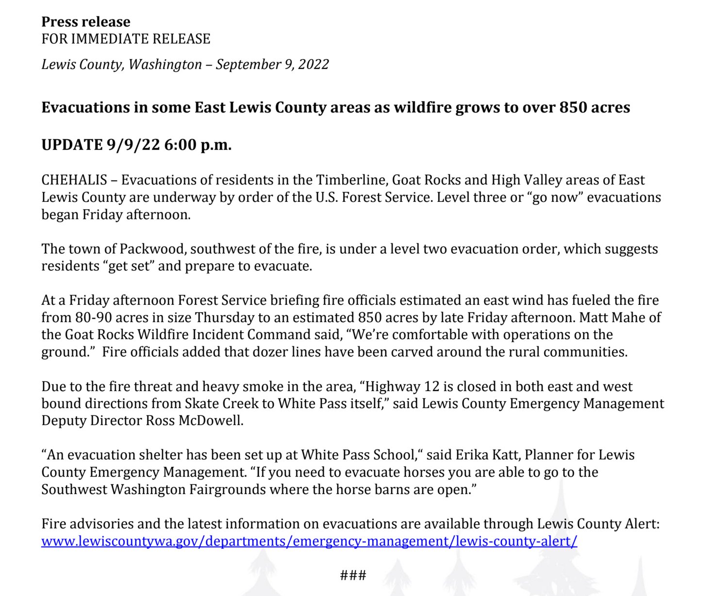
Fire officials said dozer lines have been carved around the rural communities.
“We’re comfortable with operations on the ground,” Matt Mahe, of the Goat Rocks Wildfire Incident Command, stated in the release.
Evacuations of residents in the Timberline, Goat Rocks and High Valley areas of East Lewis County are underway by order of the U.S. Forest Service. Level three or “go now” evacuations began Friday afternoon.
The town of Packwood, southwest of the fire, is under a level two evacuation order, which suggests residents “get set” and prepare to evacuate.
Due to the fire threat and heavy smoke in the area, “Highway 12 is closed in both east and west bound directions from Skate Creek to White Pass itself,” said Lewis County Emergency Management Deputy Director Ross McDowell.
“An evacuation shelter has been set up at White Pass School,“ said Erika Katt, planner for Lewis County Emergency Management. “If you need to evacuate horses you are able to go to the Southwest Washington Fairgrounds where the horse barns are open.”
Fire advisories and the latest information on evacuations are available through Lewis County Alert: www.lewiscountywa.gov/departments/emergency-management/lewis-county-alert/.
4:55 p.m. Friday Update
From Lewis County PUD: "In response to the active Goat Rocks fire; the PUD in coordination with Lewis County Emergency Management may be performing targeted power disconnections in the Packwood area. Our crews are standing by to respond as necessary. Updates will be provided when we have more info."
4:34 p.m. Friday Update:
The National Forest Service has issued an update on the Goat Rocks Fire. See it in full below.
3:45 p.m. Friday Update: ‘Growing Faster Than We Can React’: Goat Rocks Fire Less Than 3 Miles From Packwood
The Goat Rocks Wilderness fire is now 2 and a half miles away from Packwood, Lewis County officials announced just before 3:30 p.m. on Friday.
“The fire is growing faster than we can react —it has the potential for spotting,” said Matt Mahe, a member of the U.S. Forest Service's incident command for the fire, in a news release.
The fire, which was started by a lightning strike Aug. 9, had burned more than 90 acres as of Friday, according to a news release.
The fire was 80 to 90 acres in size and approximately 5 miles away from Packwood as of Wednesday.
Smoke from the fire has made it increasingly difficult for Forest Service rangers to monitor the blaze, according to a news release.
The U.S. Forest Service ordered evacuations in the Timberline, High Valley and Goat Rocks communities east of Packwood earlier Friday afternoon.
The level three evacuation notice means anyone in those areas need to leave immediately.
Packwood residents have been placed on level two evacuation notice of a high probability to evacuate and to prepare now by packing necessary items for the potential of having to depart.
Those evacuation notices had not changed as of 3:30 p.m. on Friday.
Lewis County Emergency Management Deputy Director Ross McDowel met with Lewis County Manager Erik Martin on Friday to discuss emergency plans involving Lewis County Sheriff’s deputies and local firefighters, who McDowell says may go “door-to-door” in some areas to alert people of the impending wildfire threat as is safe and necessary.
U.S. Highway 12 over White Pass has been closed.
Previous story:
Lewis County has issued level two and three evacuation notices for Packwood and the areas surrounding the Goat Rocks Wilderness Fire following the fire’s rapid growth Friday afternoon.
Goat Rock, High Valley and Timberline are at a level three “go now” evacuation, meaning there is an active danger and people need to leave now or their life could be in danger, Lewis County Emergency Management announced shortly after 1 p.m. on Friday.
The town of Packwood itself was at level two “get set” evacuation, meaning the danger is significant in the area but it’s not quite at the point where people need to leave. Residents should be “ready to evacuate at a moment’s notice,” according to Lewis County Emergency Management. Those who take longer to move, such as people with a disability and those with small children or pets, are encouraged to start evacuating at this stage.
As of 1:50 p.m. Friday, the situation was volatile and developing.
Lewis County Emergency Management is instructing evacuees to go to White Pass School, located at 516 Silverbrook Road in Randle.
The Washington state Department of Transportation (WSDOT) is preparing to close both directions of U.S. Highway 12 between Skate Creek Road in Packwood and the top of White Pass, as well as the full length of state Route 123 between state Route 410 and U.S. Highway 12, the agency announced around 1:25 p.m. on Friday.
“Smoke from the Goat Rocks Fire … burning near Packwood is making visibility difficult, since the fire grew significantly due to weather conditions,” said WSDOT in a news release, adding that the closures were requested by the U.S. Forest Service.
Local traffic will still be allowed on those closed roads. Travelers are advised to avoid the area.
The Goat Rocks Wilderness fire, which was estimated at 80 to 90 acres in size as of Wednesday, reportedly grew rapidly Friday afternoon.
The Chronicle was unable to determine the The Goat Rocks Wilderness fire's current size or the direction of the fire’s growth as of 1:45 p.m. on Friday.
The fire was estimated at 80 to 90 acres in size as of the Forest Service’s most recent update on Wednesday.
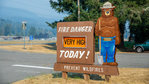
Fire danger across Gifford Pinchot National Forest, which encompasses the Goat Rocks Wilderness, was “very high” as of Friday morning, according to the U.S. Forest Service.
“When fire danger is ‘Very High’ fires start easily from any cause and can spread rapidly and increase quickly in intensity. Spot fires are a constant danger and fires burning in light fuels may quickly develop high intensity characteristics such as long-distance spotting and fire whirlwinds when they burn into heavier fuels,” said the Forest Service in a Facebook post.
Concerns about the weekend weather forecast prompted the Forest Service to meet with are area residents in Packwood on Tuesday to answer their questions and encourage them to “stay vigilant” about the possible upcoming fire danger.
The Goat Rocks Wilderness Fire was started by a lightning strike one month ago on Aug. 9. A crew of six firefighters repelled out of two helicopters into the steep terrain of the Goat Rocks Wilderness to fight a 4-acre wildfire for several days before declaring that it was 60% contained.
The remaining 40% of the fire had fallen over cliffs to the east side. The difficulty of the terrain made the rest of the fire completely inaccessible to firefighters and helicopters battling the blaze from the air.
For the next three weeks, the fire maintained a small size and footprint as the U.S. Forest Service continued monitoring it from the air, waiting for it to burn out on its own. Smoke wasn’t seen from the fire between Aug. 13 and Sept. 2, when dry, unstable air conditions caused the fire to flare up and start showing smoke again.
The fire grew from less than 4 acres to about 60 acres that day before firefighting activities and better weather over the weekend slowed its spread.
Lewis County Emergency Management will continue issuing emergency messages, including evacuation notices and shelter information, via Lewis County Alert.
Lewis County residents will need to sign up for Lewis County Alert at https://lewiscountywa.gov/departments/emergency-management/lewis-county-alert/ in order to receive emergency messages from the county.
Those who aren’t signed up can still receive evacuation notices through a separate national public safety system, Wireless Emergency Alerts (WEA), that sends geographically targeted emergency alerts to compatible mobile devices.
•••
This story will be updated.


