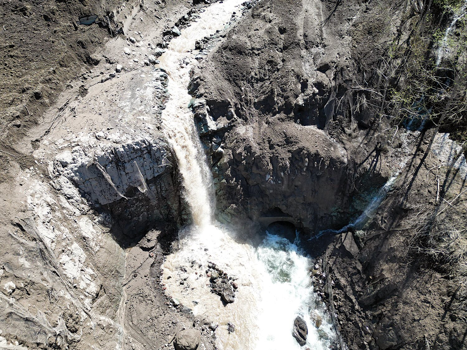
Last Friday, a national incident management team gathered to begin addressing “significant damage” caused by a landslide at milepost 49 of state Route 504, also called the Spirit Lake Memorial Highway, on May 14 around 9 p.m., according to a joint news release from the U.S. Forest Service and Washington State Department of Transportation (WSDOT).
The highway leads to the Johnston Ridge Observatory north of Mount St. Helens at the final, upper portion of the road. It is typically open to the public from May or June to October each year.
The slide washed out an 85-foot bridge, damaged the roadway and severed power to the observatory, the release stated. No one was injured from the incident, but 12 people were stranded on one side of it and stayed overnight at Johnston Ridge Observatory. They were safely flown out the following morning by the King County Sheriff’s Office.
The event followed a recent warming trend and significant snowmelt. While the exact cause is not yet known, agencies have theorized the high level of moisture destabilized the young volcanic soil, which has only been in place since Mount St. Helens erupted in 1980, 43 years ago last week.
Due to continued instability of the ground, surveying the slide for damage must be done in the air, WSDOT stated. Late last week, the department was scheduled to conduct a LIDAR (laser imaging, detection and ranging) flight over the area for preliminary data. U.S. Forest Service spokesperson Gala Miller told The Chronicle it could take weeks for the LIDAR data to come back, and that travelers should expect the road to remain closed at least up to Johnston Ridge for the remainder of the summer.
There is currently no access to Coldwater Lake nor the Hummocks Trail, but openings and closures could take place throughout the season as the area becomes more or less safe, Miller said.
For safety, WSDOT and federal agencies strongly encourage people not to venture beyond the highway closure location due to the unstable hillside.
For updates from the U.S. Forest Service:
• Website: https://www.fs.usda.gov/giffordpinchot
• News and alerts: https://www.fs.usda.gov/alerts/giffordpinchot/alerts-notices/?aid=80265
• Sign up for news updates: https://www.fs.usda.gov/news/giffordpinchot/news-events
• Facebook: https://www.facebook.com/GiffordPinchot/
• Twitter: https://twitter.com/gpnf
For updates from the Washington State Department of Transportation:
•Website: https://wsdot.wa.gov/
• Sign up for email updates: https://public.govdelivery.com/accounts/WADOT/subscriber/new
• Facebook: https://www.facebook.com/WSDOT/
• Twitter: https://twitter.com/wsdot/
• Flickr: https://www.flickr.com/photos/wsdot/


