

An active weather pattern is expected to bring moderate to heavy rainfall and upwards of 3 inches of precipitation to the Twin Cities on Thursday, thrusting the area into a flood watch expected to last through Saturday afternoon.
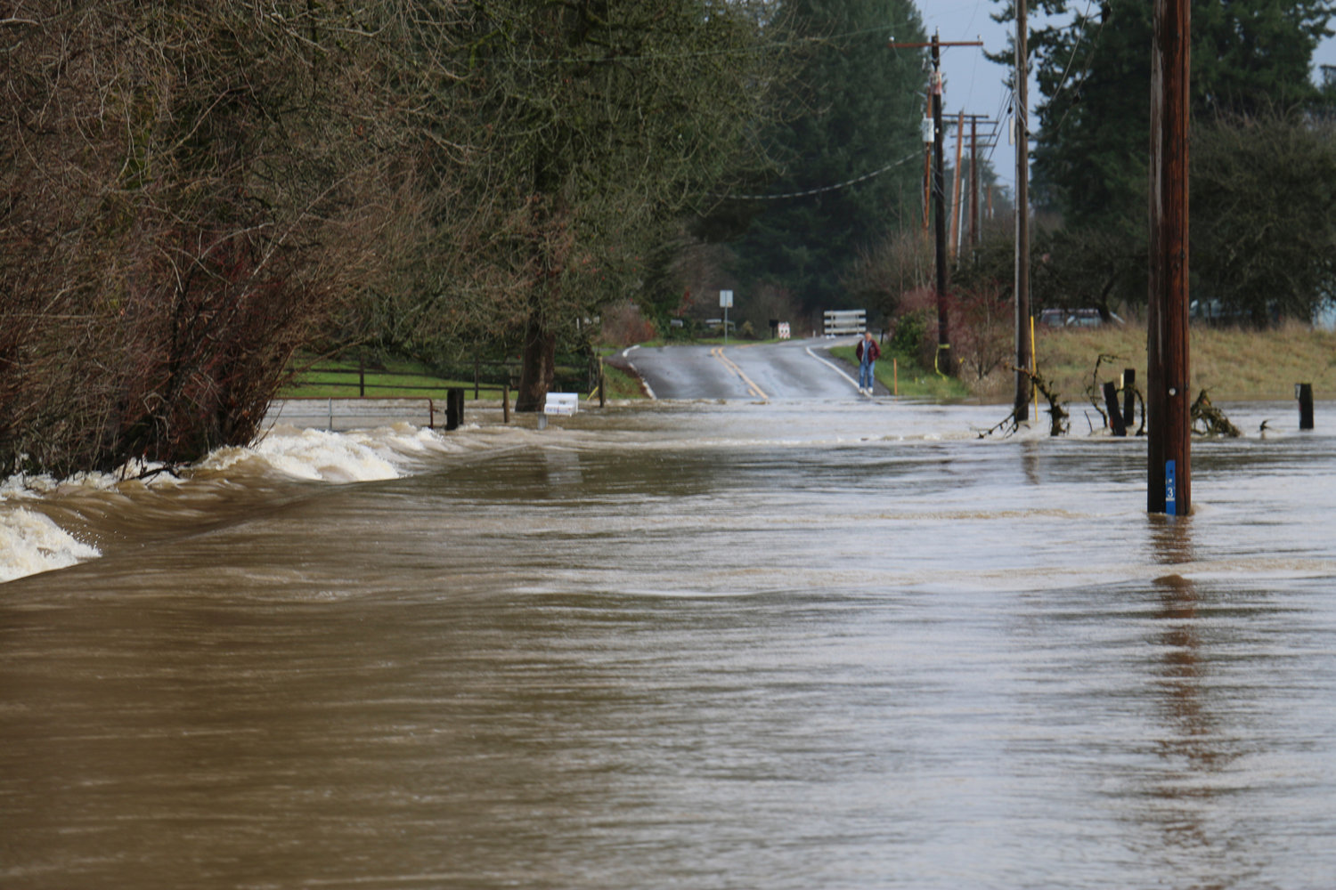
Major flooding Friday along sections of the Chehalis and Newaukum rivers is likely, according to the National Weather Service in Seattle, with a chance of record flooding at points along both rivers.
“Excessive runoff may result in flooding of rivers, creeks, streams and other low-lying and flood-prone locations,” an alert from NWS Seattle read. “Creeks and streams may rise out of their banks. Melting lowland snow will contribute to the flood potential and to soil saturation, and thus increasing the threat of landslides.”
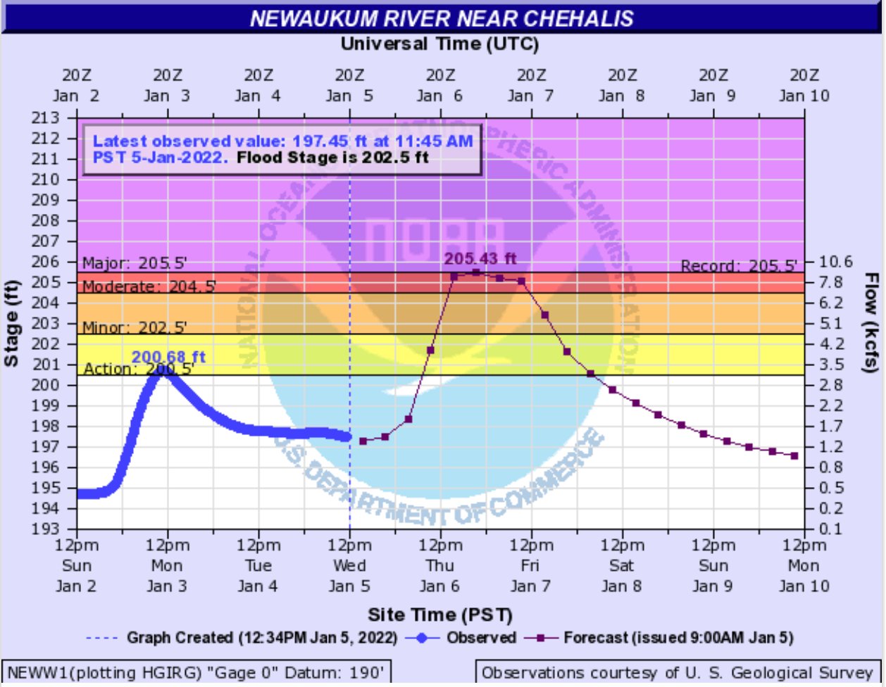
As of Wednesday morning, the Newaukum River at Chehalis was forecasted to crest on Thursday night less than an inch below the 1996 record of 205.5 feet, just below “major flooding” designation, according to the NWS’s Advanced Hydrologic Prediction Service.
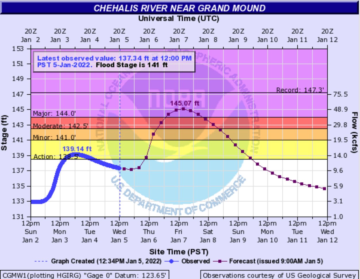
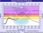
The Chehalis River at Grand Mound is expected to crest Friday afternoon in “major flooding” designation. Current forecasts show the river is expected to peak about 2 feet below the historic 2007 crest of 147.3 feet.
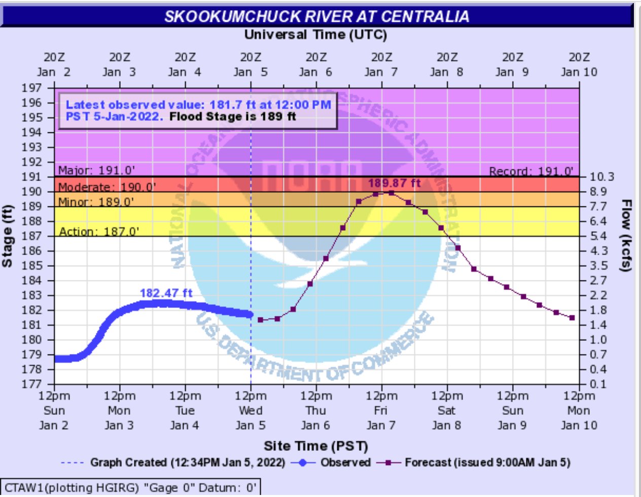
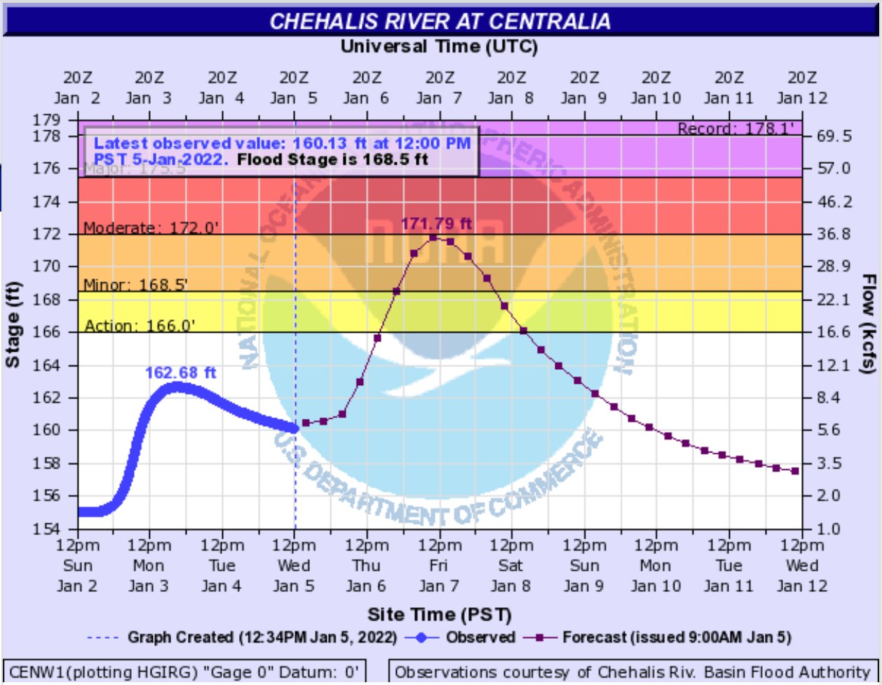
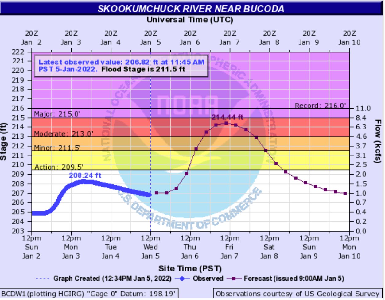
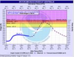
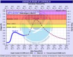
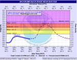
The Chehalis River at Porter, in Grays Harbor County, and the Skookumchuck River at Bucoda, in Thurston County, are both currently forecasted to see “moderate flooding,” according to NWS Seattle. The Chehalis at Centralia and Skookumchuck at Centralia are both projected to crest into “minor flooding” this week.
At a Wednesday meeting with the Lewis County Board of Commissioners, Lewis County Emergency Management Deputy Director Ross McDowell said he was doubtful of the low forecasted river gauges along the Cowlitz River in East Lewis County. Neither gauge at Randle or Packwood are forecasting flooding.
“My biggest concern as far as the east end of the county, (NWS) is showing with continued rain that we’re going to start seeing today, through Thursday and through Friday, that the Cowlitz River is only going to raise 5 feet, which is still underneath flood stage. But, the problem is that the snow level is going to jump up to 5,000 feet, which means when you have rain on top of that it’s really going to melt that snow pretty quick,” he said.
Mostly rain, with a bit of snowfall, is expected in the lowlands the rest of the weekend, according to the NWS forecast at the Chehalis-Centralia Airport. Next week will start off with mostly clouds, with continued chances of rainfall.
A winter storm warning was also in effect for much of the Cascades in Washington state, and portions of some mountain valleys in Lewis County. Heavy snowfall is expected Wednesday through Thursday above 1,500 feet.
White Pass was closed earlier this week due to multiple snow slides, high winds and undriveable conditions. Cascade mountain passes have been experiencing heavier than average snowfall this year, with the Interstate 90 Snoqualmie Pass experiencing a record amount.
Conditions, chaining requirements and more information on WSDOT mountain passes can be found online at www.wsdot.com/travel/real-time/mountainpasses.
•••
To see updated river predictions and find other resources and information about local flooding, visit Lewis County’s web site at https://lewiscountywa.gov/departments/emergency-management/flood-information/


