After a weekend of heavy wildfire smoke, Seattle and the Cascade mountains can expect some relief this week — in the form of rain.
From Friday through Sunday, Seattle is likely to see more rain than it's gotten over the last three and a half months combined, according to Dana Felton, meteorologist for the National Weather Service of Seattle. The region is expected to receive substantial rain on Friday, followed by light showers Saturday and more heavy rain on Sunday.
"That's gonna be the beginning of fall — finally," Felton said Monday morning.
Since July 4, Seattle has received four-tenths of an inch of rain. On Sunday, Seattle broke the record for the hottest temperature this late in the year, reaching an official high of 88 degrees at Seattle-Tacoma International Airport.
Until the first large rain system moves into the region on Friday, temperatures will remain unseasonably warm. But we won't see temperatures in the 80-degree range, like we did this past weekend. Highs will be range from 65 to 70, Felton said.
And until those big, glorious drops start falling from the sky on Friday, expect to see some haze and continued wildfire smoke.
The Washington Smoke Blog is reporting moderate levels on the air quality index for much of the region. Winds were moving east from the ocean Monday morning, which helped lessen and disperse some of the weekend's heavy haze. But that wind will cease by Monday evening, according to the National Weather Service.
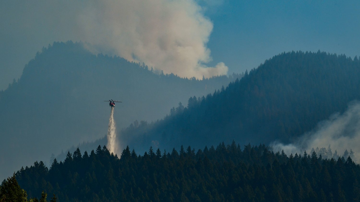
As of Sunday evening, several fires in Washington were spreading due to dry and windy conditions.
In the south Cascades, the Nakia Creek fire near Camas grew rapidly yesterday. 2,900 homes were under Level 3 (leave now) evacuation orders as of Sunday night. Around 40,00 homes and businesses were under some form of evacuation notice as the fire grew from 156 acres Sunday morning to 1,565 acres overnight, according to Trina Contreras, spokesperson for the state Department of Natural Resources.
"We just had some crazy gusty hot winds up there and it took off," Contreras said. To fight the much bigger blaze, a Type 2 of forest firefighters — trained to fight larger fires — from Oregon will be arriving Monday to relieve the Type 3 team. Only 5% of the fire is currently contained, Contreras said Monday morning.
The Loch Katrine fire, located 30 miles east of Seattle, expanded to more than 2,000 acres Saturday night. The 8 Road fire, slightly north of Elbe in Pierce County, was estimated at 150 acres Sunday.
The Bolt Creek fire, which has been burning since early September, was 41% contained Monday morning. A portion of Highway 2 near Skykomish was closed multiple times Sunday due to the Bolt Creek fire. No delays or closures are currently planned for Monday, unless debris enters the roadway, according to the fire's incident command webpage.
For the North and Central Cascades, people can expect to see around a half-inch of rain from 5 to 11 p.m. Friday alone. Saturday will likely see some light showers, with a second system moving in Sunday and that could bring a half-inch of rain over 12 hours to the mountains, Felton said. Conditions will be windy as well over the weekend.
The rain in the Cascade mountains will "definitely help the fires," Felton said.
Seattleites can expect anywhere from three tenths to close to half an inch of rain starting Friday afternoon and going into Saturday. Another tenth to two tenths an inch of rain is currently forecasted for Sunday.
"This is what I would call a pattern breaker," Felton said. "We'll be kicking in the fall weather."


