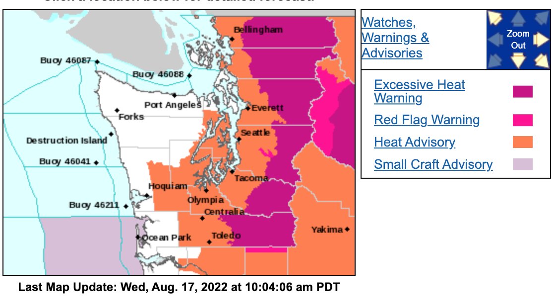
East Lewis County and much of central Washington is under a red flag warning — meaning weather conditions are unstable and bring a high risk for wildfire — through 10 p.m. on Thursday, the National Weather Service (NWS) announced Tuesday.
NWS forecasts temperatures in the upper 90s, with some areas approaching 100 degrees, as well as low humidity and strong winds through Thursday night.
“Temperatures will fall by Friday but are expected to remain above normal for the foreseeable future,” NWS’s Seattle station wrote in a Facebook post on Tuesday. “Even though we've experienced heat this season, it's important not to let your guard down and keep the signs of heat illness in mind!”
Thurston County and West Lewis County are under a heat advisory warning, meaning temperatures are forecasted to reach the 90s and there’s a moderate risk for heat-related illness. East Lewis County and the rest of the Cascade foothills, where temperatures are forecast to approach 100 degrees, is under an extreme heat warning, meaning there’s a very high risk of heat-related illness.
Overnight lows should remain in the 60s, according to NWS.
The warnings went into effect between 11 a.m. and noon on Wednesday.
Lewis County Emergency Management maintains a current list of open cooling shelters on its website, https://lewiscountywa.gov/departments/emergency-management/. The site also includes tips on keeping people and pets safe in extreme heat.
“Be cautious, stay hydrated, stay cool and stay safe, Lewis County!” stated Emergency Management in a Facebook post on Wednesday.


