Firefighters working on the Goat Rocks Fire just outside of Packwood are likely to see some easier days ahead as marine weather and moisture blow in from the coast, changing the relative humidity from 60% to 90%.
During an update in the courthouse on Wednesday morning, Lewis County Division of Emergency Management Deputy Director Ross McDowell said, “The weather, obviously you saw it this morning, and they saw it out there (in Packwood), too.”
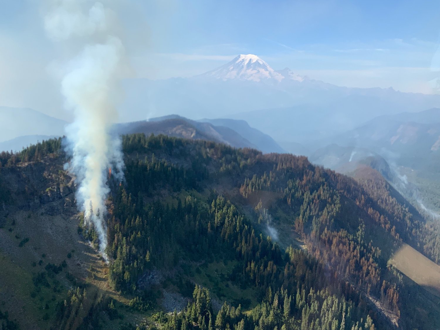
McDowell reported the fire had grown to 4,029 acres and that 202 people were working on keeping it contained as of Wednesday. The fire remains 0% contained.
Neighborhoods northeast of Butter Creek and in Lower Timberline and Goat Rocks are still at evacuation level one, “be ready.” The Upper Timberline area remains at level two, “be set.”
After a red flag warning was put in place due to windy, dry conditions on Monday, Packwood residents saw an increase in smoke. While more smoke doesn’t necessarily equal more fire, McDowell said, the winds pushing smoke to the west caused ash to snow down on residential areas. Fortunately, with winds blowing toward the east for the next few days, that should be less of an issue.
On Tuesday, officials considered closing U.S. Highway 12 due to low visibility from smoke, McDowell said, but eventually decided against the move, which he said was the right call in the end. Members of the public should use caution on roadways with smoke by driving slowly and turning on low-beam headlights, according to a news release from the Forest Service.
“The way it looks with the weather conditions in the next week, the red flags will stay away. We’re hoping. That’s me knocking on wood there,” McDowell said.
The blaze currently stretches three fingers out in different directions. The western finger, less than one half mile from the Upper Timberline neighborhood, is the closest to structures and therefore remains the highest containment priority for crews. A southern-reaching finger of the fire extends toward Packwood lake, and on the eastern side, the blaze continues to scorch old growth forest, including trees previously measured at over 600 years old.
For information on protecting property from fires, search for firewise.org. To receive alerts from Lewis County in the case of an emergency, residents can sign up at https://lewiscountywa.gov/departments/emergency-management/lewis-county-alert/.
For current road and trail closures, visit https://www.fs.usda.gov/Internet/FSE_DOCUMENTS/fseprd1060181.pdf


