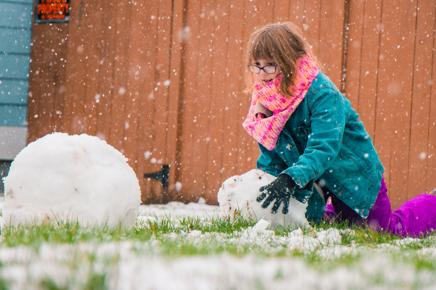
Krystin Harris, 10, smiles as she gathers snow for a snowman in front of her Chehalis home Thursday afternoon.
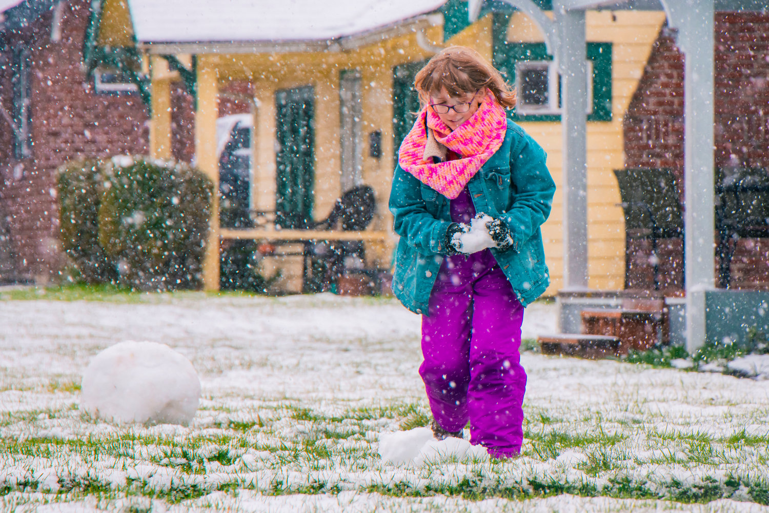
Krystin Harris, 10, smiles as she gathers snow for a snowman in front of her Chehalis home Thursday afternoon.
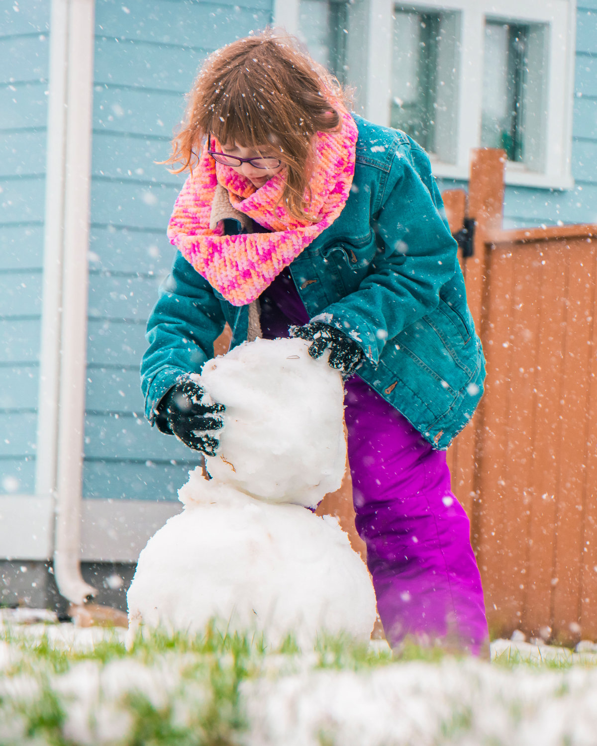
Krystin Harris, 10, gathers snow for a snowman in front of her Chehalis home Thursday afternoon.
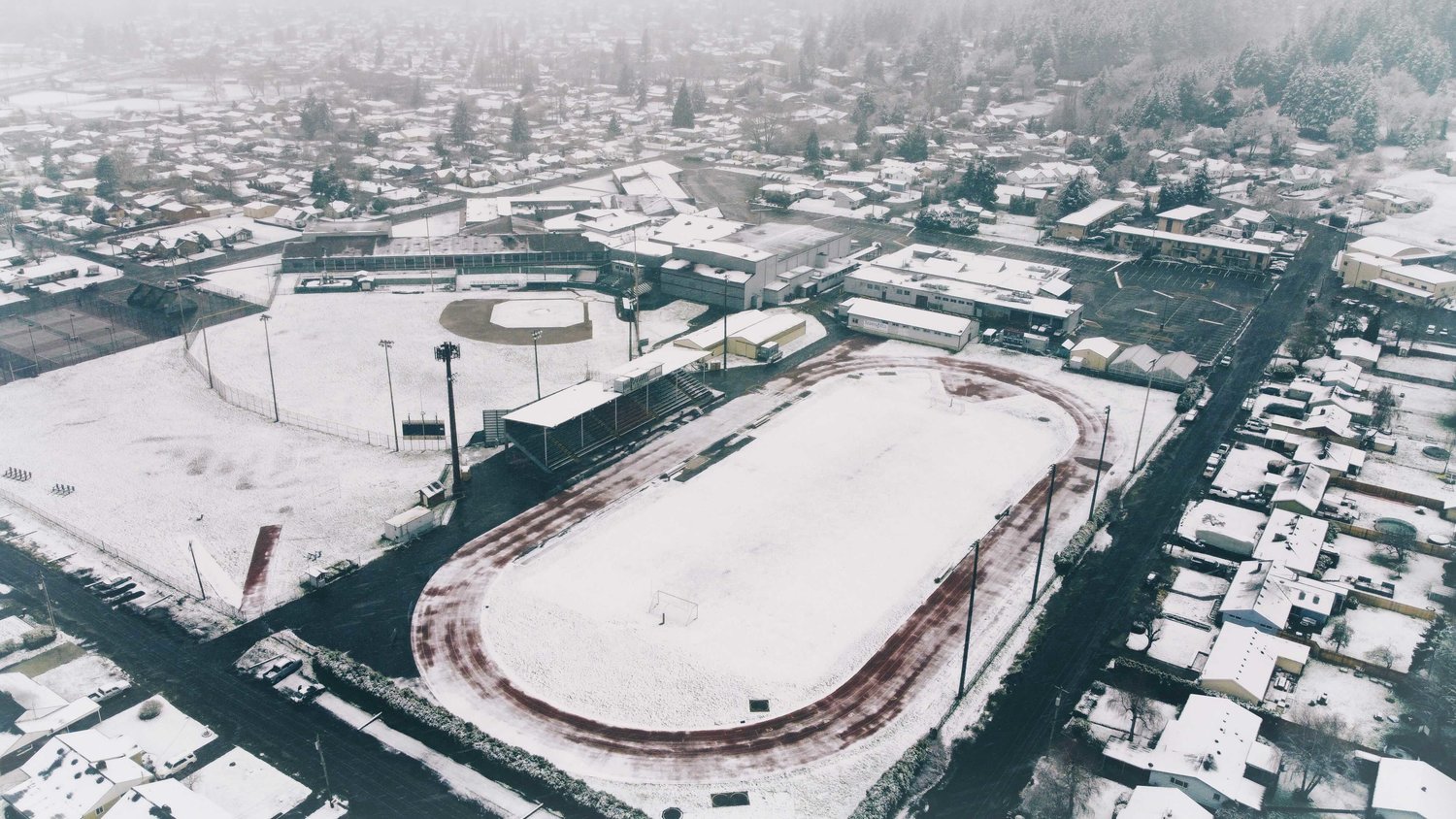

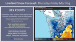


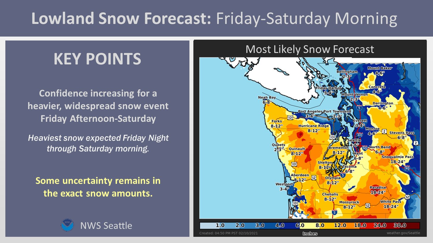
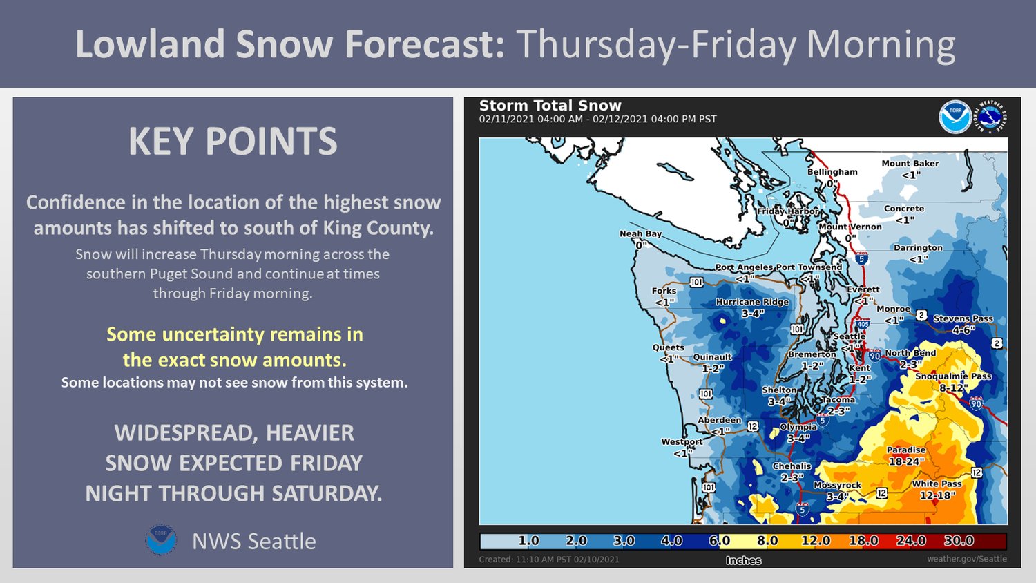
The National Weather Service predicts an additional round of snow will hit the region on Friday even as accumulation from the first round of winter weather continues.
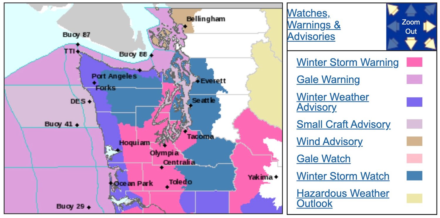
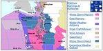
Here are the current advisories as of Thursday afternoon from the National Weather Service:
Winter Storm Watch
URGENT - WINTER WEATHER MESSAGE
National Weather Service Seattle WA
244 PM PST Thu Feb 11 2021
WAZ504-509-511-512-121400-
/O.CON.KSEW.WS.W.0007.000000T0000Z-210212T1400Z/
/O.CON.KSEW.WS.A.0003.210212T1400Z-210214T0000Z/
Southwest Interior-Tacoma Area-Hood Canal Area-
Lower Chehalis Valley Area-
including Lacey, Olympia, Tumwater, Yelm, Grand Mound, Rochester,
Centralia, Toledo, Tacoma, Fife, DuPont, Puyallup, Shelton,
Seabeck, Belfair, Brinnon, Montesano, Elma, and McCleary
244 PM PST Thu Feb 11 2021
...WINTER STORM WARNING REMAINS IN EFFECT UNTIL 6 AM PST FRIDAY...
...WINTER STORM WATCH REMAINS IN EFFECT FROM FRIDAY MORNING
THROUGH SATURDAY AFTERNOON...
* WHAT...For the Winter Storm Warning, heavy snow continued.
Additional snow accumulations of up to 4 inches. For the Winter
Storm Watch, heavy snow possible. Total snow accumulations of 6
to 11 inches possible.
* WHERE...Tacoma and vicinity, including Vaughn, Gig Harbor, Fox
Island, Anderson Island, DuPont, Puyallup, and Spanaway, Far
southwest Mason County and the interior lowlands of Grays
Harbor County, including Matlock, McCleary, and Montesano,
Western Kitsap and the lowlands of eastern Jefferson and Mason
Counties, including Brinnon, Seabeck, and Shelton and Lowlands
of Thurston, western Lewis, and far southeast Mason Counties,
including Harstine Island, Olympia, Centralia, and Toledo.
* WHEN...For the Winter Storm Warning, until 6 AM PST Friday.
For the Winter Storm Watch, from Friday morning through
Saturday afternoon.
* IMPACTS...Travel could be very difficult to impossible.
PRECAUTIONARY/PREPAREDNESS ACTIONS...
If you must travel, keep an extra flashlight, food, and water in
your vehicle in case of an emergency.
Monitor the latest forecasts for updates on this situation.
For the latest road conditions in Washington state, call 5 1 1.
&&
$$
Winter Storm Warning
URGENT - WINTER WEATHER MESSAGE
National Weather Service Seattle WA
244 PM PST Thu Feb 11 2021
WAZ504-509-511-512-121400-
/O.CON.KSEW.WS.W.0007.000000T0000Z-210212T1400Z/
/O.CON.KSEW.WS.A.0003.210212T1400Z-210214T0000Z/
Southwest Interior-Tacoma Area-Hood Canal Area-
Lower Chehalis Valley Area-
including Lacey, Olympia, Tumwater, Yelm, Grand Mound, Rochester,
Centralia, Toledo, Tacoma, Fife, DuPont, Puyallup, Shelton,
Seabeck, Belfair, Brinnon, Montesano, Elma, and McCleary
244 PM PST Thu Feb 11 2021
...WINTER STORM WARNING REMAINS IN EFFECT UNTIL 6 AM PST FRIDAY...
...WINTER STORM WATCH REMAINS IN EFFECT FROM FRIDAY MORNING
THROUGH SATURDAY AFTERNOON...
* WHAT...For the Winter Storm Warning, heavy snow continued.
Additional snow accumulations of up to 4 inches. For the Winter
Storm Watch, heavy snow possible. Total snow accumulations of 6
to 11 inches possible.
* WHERE...Tacoma and vicinity, including Vaughn, Gig Harbor, Fox
Island, Anderson Island, DuPont, Puyallup, and Spanaway, Far
southwest Mason County and the interior lowlands of Grays
Harbor County, including Matlock, McCleary, and Montesano,
Western Kitsap and the lowlands of eastern Jefferson and Mason
Counties, including Brinnon, Seabeck, and Shelton and Lowlands
of Thurston, western Lewis, and far southeast Mason Counties,
including Harstine Island, Olympia, Centralia, and Toledo.
* WHEN...For the Winter Storm Warning, until 6 AM PST Friday.
For the Winter Storm Watch, from Friday morning through
Saturday afternoon.
* IMPACTS...Travel could be very difficult to impossible.
PRECAUTIONARY/PREPAREDNESS ACTIONS...
If you must travel, keep an extra flashlight, food, and water in
your vehicle in case of an emergency.
Monitor the latest forecasts for updates on this situation.
For the latest road conditions in Washington state, call 5 1 1.


