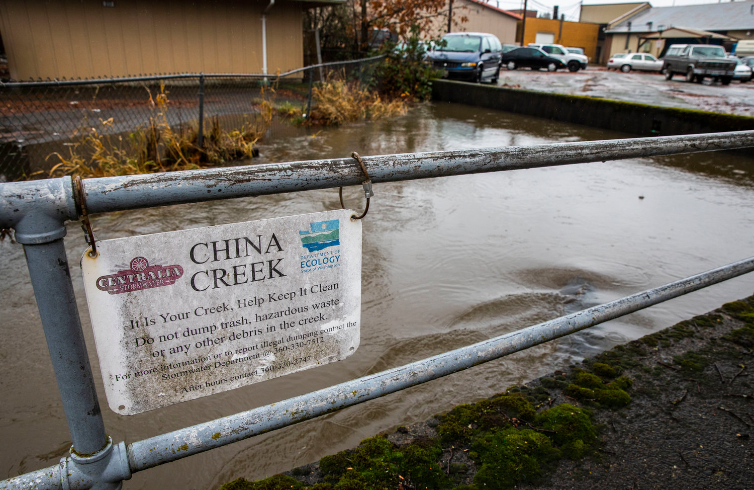


Centralia residents don’t have to schedule a visit to China Creek; it visits them.
Occasionally, the creek’s floods damage homes and businesses, block roadways and spill mud throughout the Hub City.
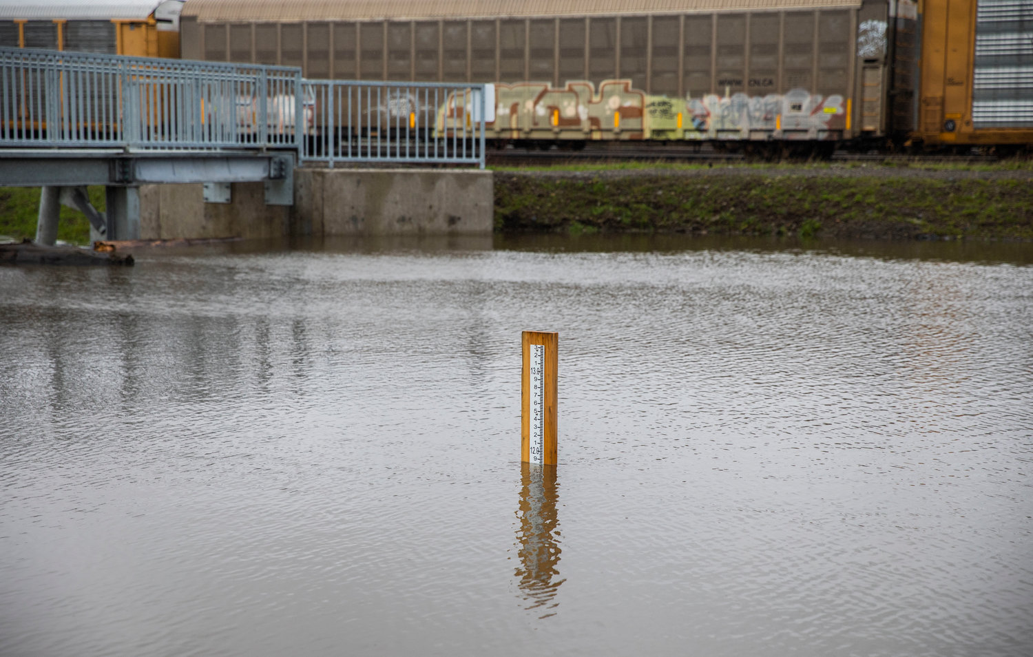
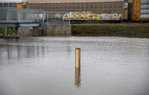
For years, heavy rain events left officials using estimated guesses on whether the waterway would top its banks — but no longer. Thanks to the November installation of a USGS river gauge, Centralia Public Works Director Kim Ashmore can now report precisely when the water is rising or falling.
Following a night of heavy rain, the creek’s gauge had its first chance to prove its worth Tuesday morning. Even before the creek crested at about 189 feet above sea level between 10:30 a.m. and 1 p.m., the gauge allowed the Chehalis River Basin Flood Authority to warn residents of high water through its email alert system.
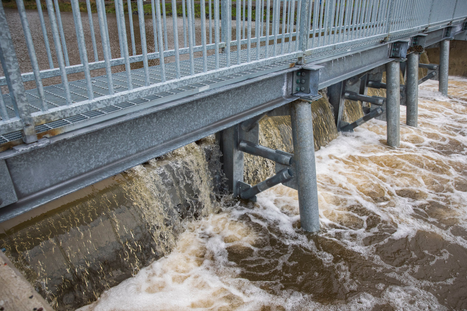
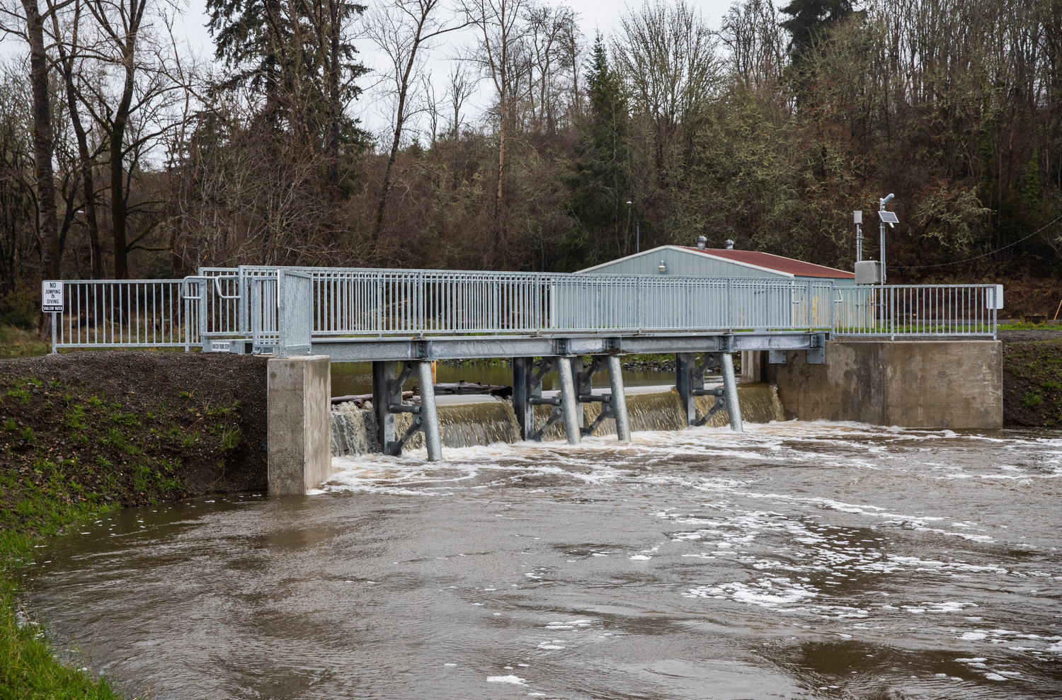
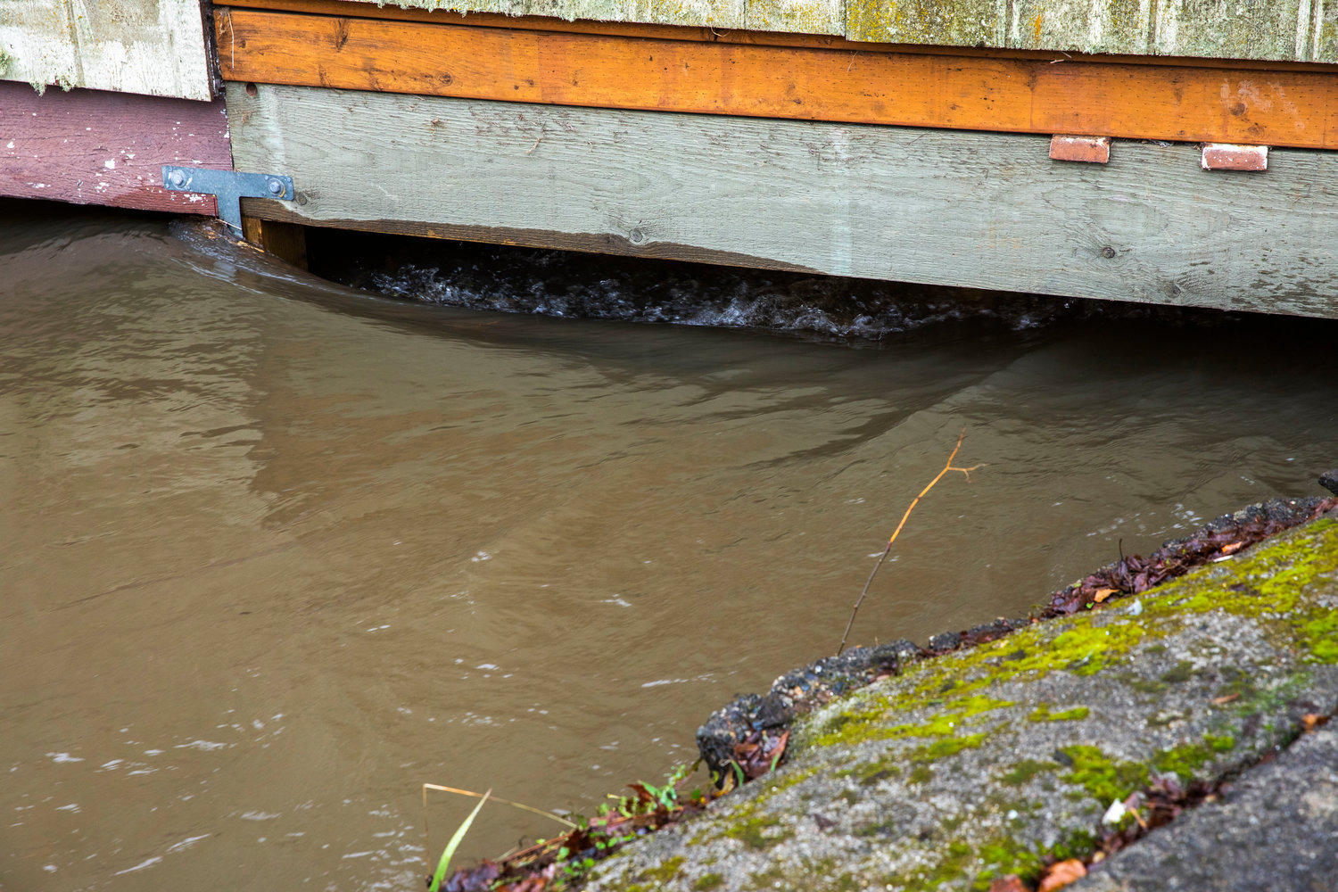
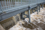
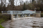
The gauge is placed at the China Creek Project weir, a small, dam-like concrete structure that still allows fish passage. During a 2.5 inch 24-hour rainfall, the weir can hold back 3.6 inches of water, potentially from inundating businesses or living quarters.
While the gauge’s first wet run provided a chance for the city’s public works team to use their new sandbag machine, the creek fortunately did not top its banks before receding on Tuesday. Throughout the day, Ashmore said, staff were monitoring the creek at the site of the weir, behind The Chronicle and behind Eubanks Glass. Residents in the area along Magnolia Street were provided sandbags as a precaution.
Scott Boettcher, with the flood authority, said while the gauge is still “brand new,” rain events such as this week’s help fine tune the alert system. He said it takes about two flood seasons to calibrate the perfect time for the gauge to send off alerts, as the authority aims to strike a balance between unnecessary worry and notifying residents too late.
“This is the very first opportunity to reflect. So that then, we can say, ‘We really understand this so we’re going to set the alarm at the right flood stage,’” Boettcher said. “That’s the learning process that’s underway right now.”
Using the flood authority’s website, residents can track the Chehalis River Basin’s 13 gauges, including those along the Newaukum and Skookumchuck rivers. For China Creek, the alert system goes off when the water tops the weir. As it is a flood control structure (FCS), this triggers an email saying “China Creek above FCS” when the water hits 187 feet above sea level.
Learn more about the gauges or sign up for high water alerts throughout the basin at https://chehalis.onerain.com/.


